Assorted maps
Eleven maps from the last two years that didn't make it to the website in their own right.
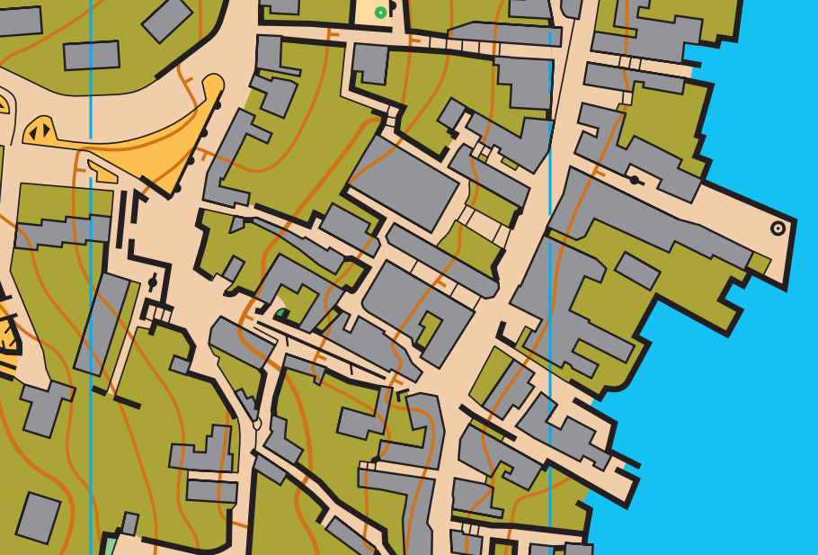
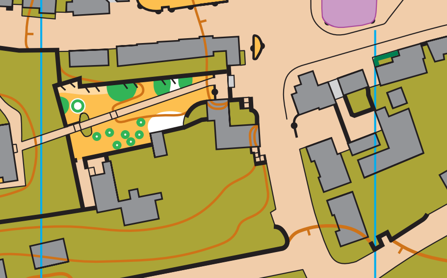
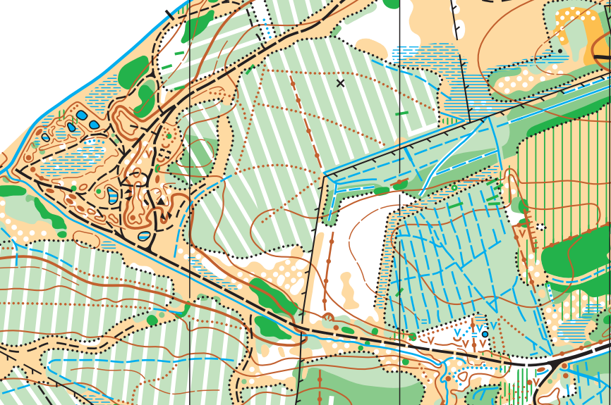
Falkirk Wheel
Lots of human activity in an area usually makes for challenging mapping. ISOM works most naturally when the forest is wilderness, untouched by man. In this example, the long linear reentrant and parallel earthwall are the line of the Antonine Wall, built around 150 AD. The track parallel to the railway in the SW is the route of a Roman road and the railway was (I think) built in Victorian times. Falkirk Wheel itself, with the canal and tunnel (not mapped), was built in 2002. I have no idea when the various fences were built, nor the (unmapped) power lines which run along the linear rough open areas. The black circle in the west is a forest school (which has been heavily simplified).
Mapped in October 2024, FVO used this map last weekend for the Scottish Score Champs: Routegadget.
Burnley East
A fairly standard urban map covering a large area of suburban Burnley, including Turf Moor! I mapped it in October 2023 so there are some bits of untidiness I'd fix now - the gaps in the form lines haven't been made nice, and the scattered trees cuts some of the white circles partway through. The fence tags aren't perfect either.
PFO used this map for a North-West Urban League event in April 2024: Routegadget.
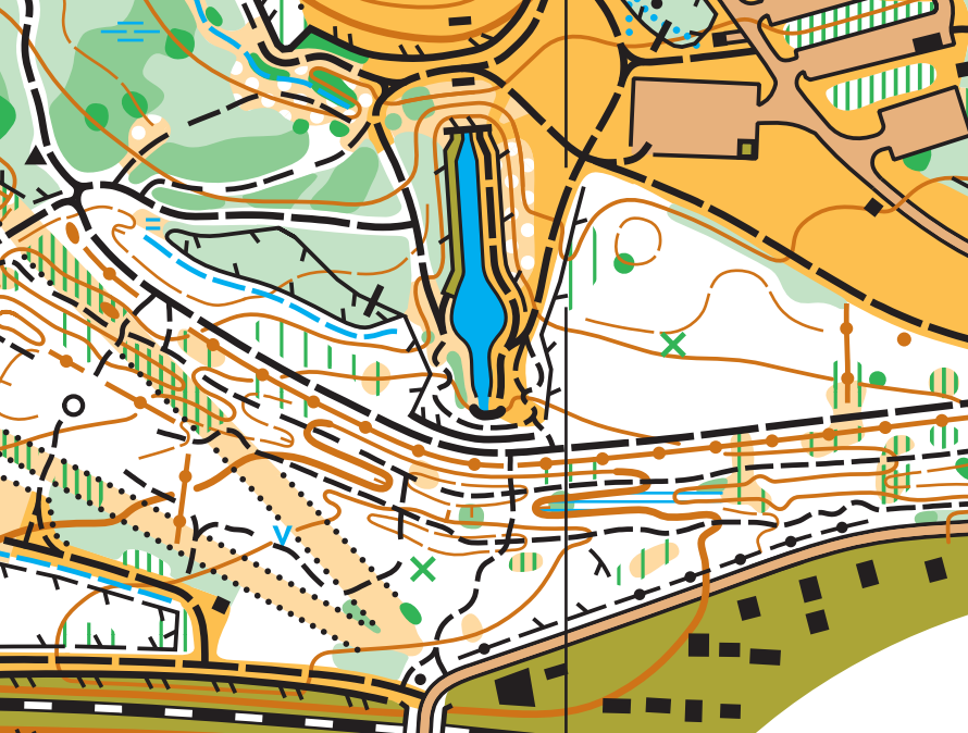
Clackmannan
Another fairly standard sprint map, but a good chance to show an example of how contours should work. Contours inside buildings clearly don't mean anything in themselves, but here they show that the walls and steps on each side of the building are about 2 contours high. Contours cross roads at, or close to, 90 degrees, and with tags, because when you make a route choice in sprint you usually only look at the routes i.e. the roads, so tags means you can assess the climb without having to look elsewhere to work out which way is up/down. Inside olive green areas any contour detail is useless, so in fact arguably I've mapped a slight reentrant here that should be smoothed out.
Mapped in Nov-Dec 2023 and used for Masterplan Adventure's Christmas Cup Day 4 on New Year's Day 2024. Livelox.
Magilligan Strand (Update)
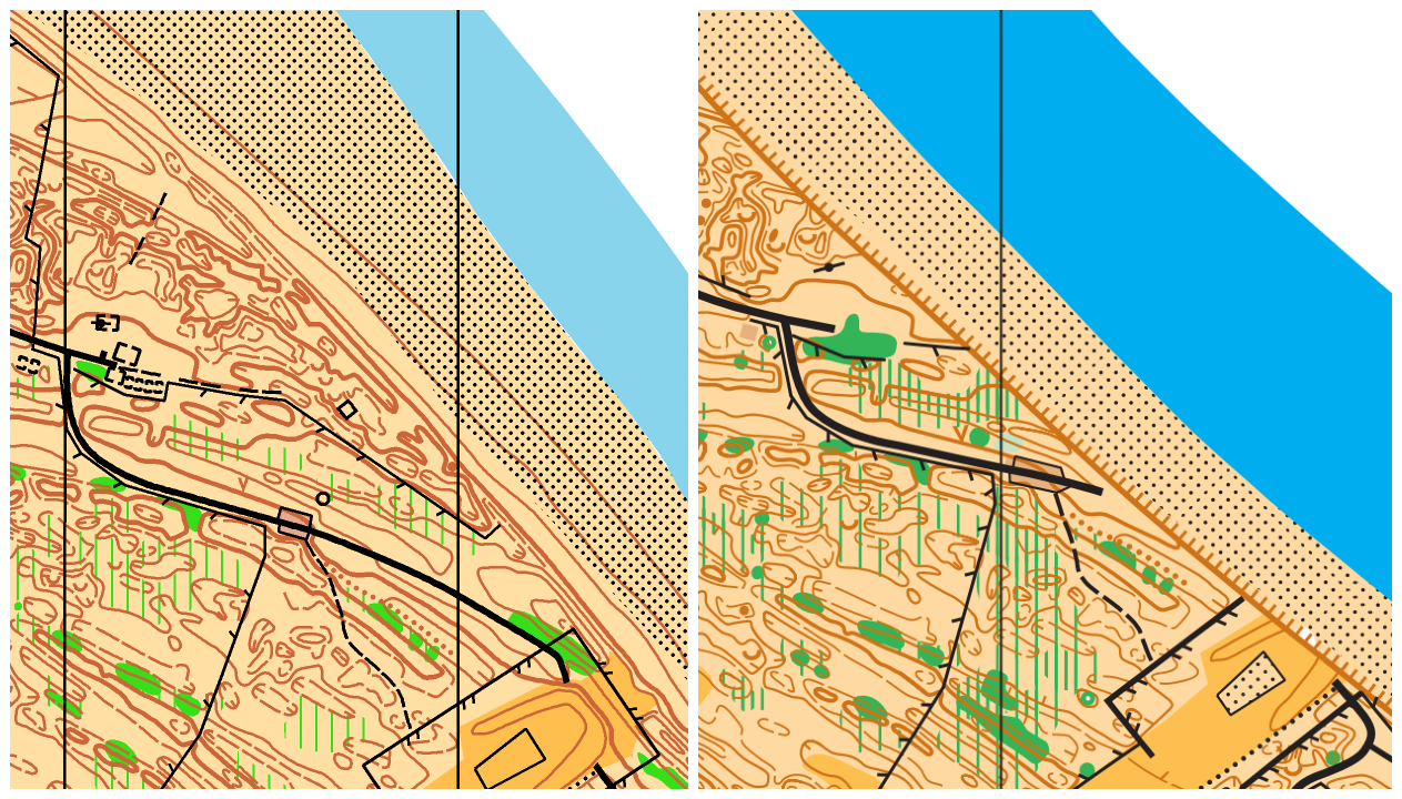
In September 2024 I spent a week in Northern Ireland updating a huge sand dune area for the 2025 Irish Champs. In one section the coast had been eroded by nearly 100m! As well as updating the vegetation and paths etc, the symbols had to be converted to the latest spec and whilst I couldn't re-draw all the contours, I did my best to make them a little more readable in places. Irish Champs Routegadget Middle and Long.
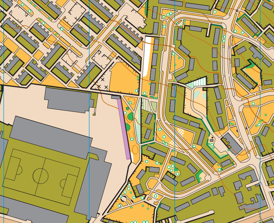
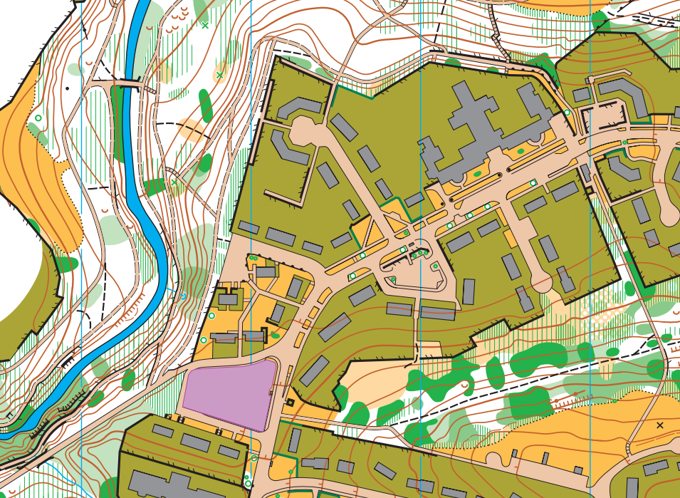
Thompson and Queen's Parks, Burnley
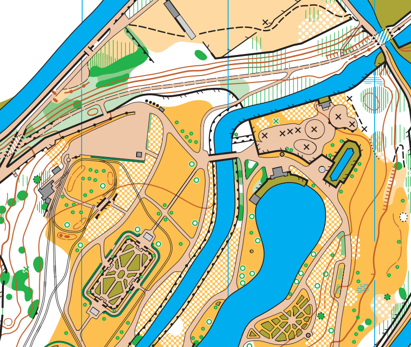
An interesting area comprising three parks with rivers and canals running through them. Victorian style formal gardens and a small railway were a challenge to map legibly! There was even an aqueduct! Mapped in December 2024, I'm now being careful with not leaving half a white circle at the edges of the scattered trees areas (except when bounded by e.g. a black line) and it looks much cleaner.
Nibon
The first of the maps I made for Coast & Islands 2025. I did this one and the Lerwick sprint map in August 2024, taking just my bike, panniers and a tent to Shetland. I camped in one of the valleys on the Nibon map for a few days whilst doing the fieldwork, which included one whole day in the tent when a storm came through! Coast & Islands Day 1 Livelox. (White is open!)
Limerigg
I think some of the people who ran the event here in April this year vowed afterwards never to return. Large swathes of spiky spruce plantation forest mixed with felled areas full of brambles, and the occasional patch of detail. One of the reasons I enjoy mapping is that it's nicer to be out in the forests and hills than sat at a desk in an office, but doing fieldwork at Limerigg in February-March, wearing five layers and two pairs of gloves, I was questioning my choices. And just when I thought I'd finished, FVO sent me back out there to do an extension! Routegadget.
Westquarter Glen
A suburb of Falkirk which actually has quite a lot of woodland between the blocks of housing. The slopes are fairly big which makes for interesting longer route choices. It can be tricky to keep things readable when you get paths traversing steep slopes, especially if there are other black features like fences and crags, so sometimes it's necessary to distort things from their true positions to keep the legibility; no-one will notice the distortion, it only seems big when you're zoomed right in.
Riverside Park, Glenrothes
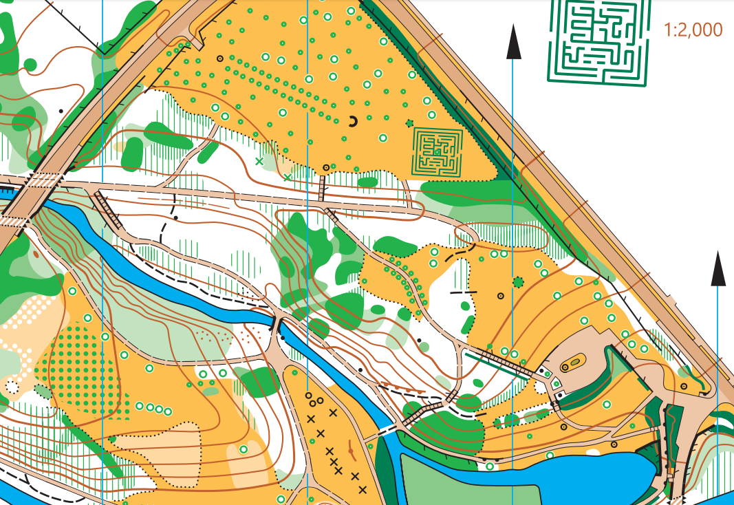
A fairly standard park, but with added interest of a maze, some stepping stones across the river and various bridges. The orchard symbol got a rare outing, and though for some reason the edges look untidy on this image I promise they look neat on the OCAD! To the east of there, I kept the broken ground dots from touching the contours, which I think is the correct thing to do, but I hope no-one interpreted it as four separate areas of broken ground. There wasn't a lot of contour detail in this area so I kept them nice and smooth. KFO used it for a local event recently. Routegadget.
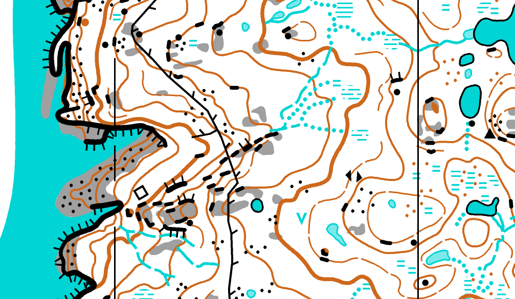
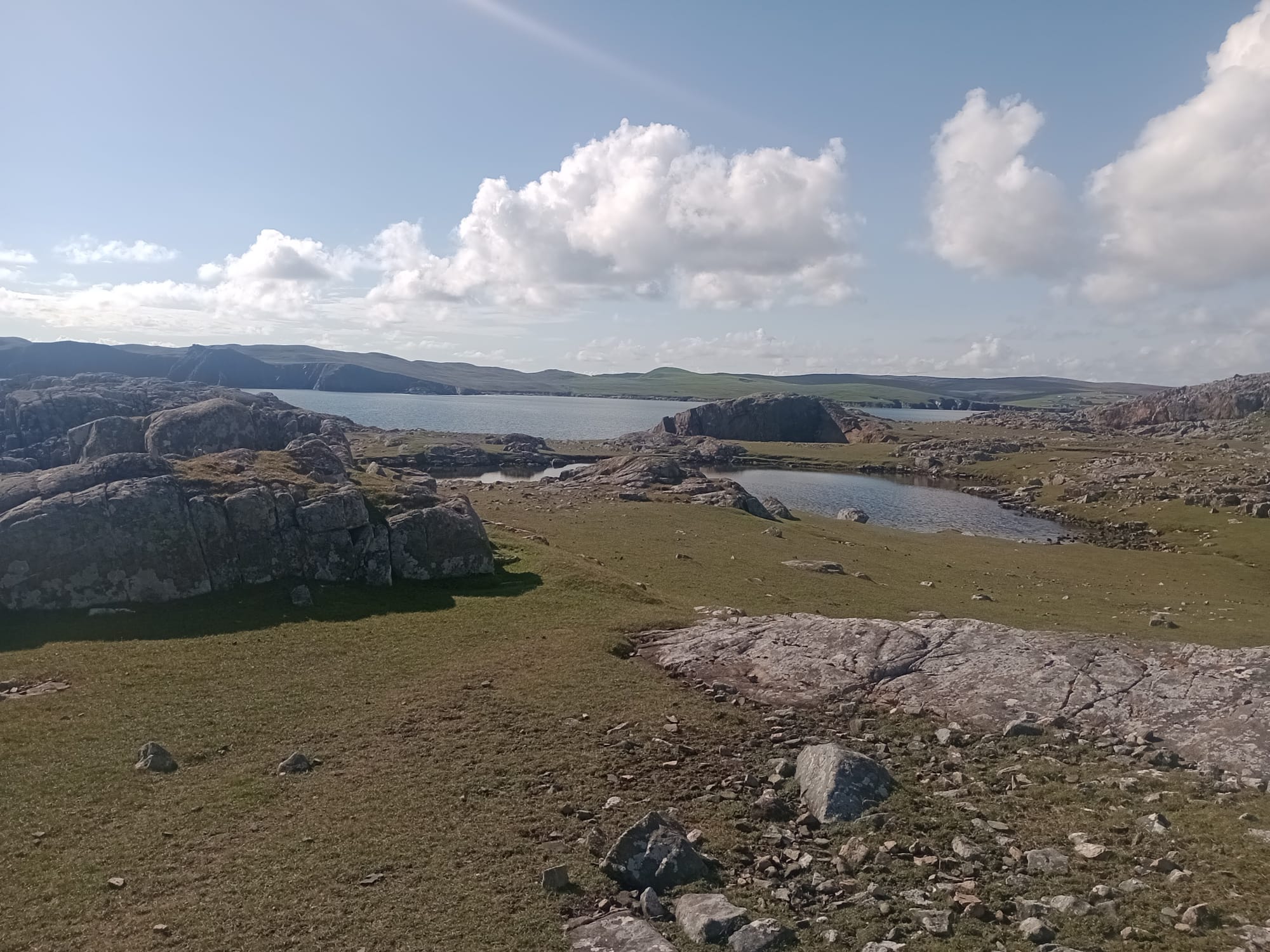
Hamar
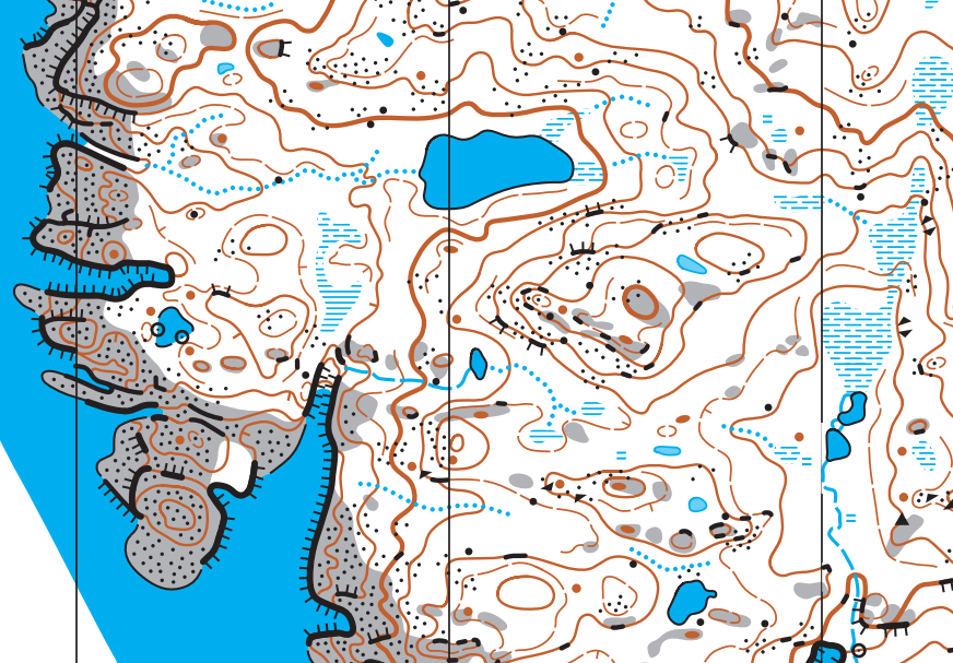
The most northerly map in the UK! Another map for Coast & Islands 2025, this was a pleasure to map on sunny days in early June. It has perhaps some of the most scenic control locations you could wish for, but also a few 30m+ vertical cliffs into the sea to watch out for! Comparing this map with the Nibon map done nearly a year earlier, I would like to think the cartography is nicer on this one, though I'm sure still improvements to be made.
Stromness
Last but not least, I made this map whilst passing through Orkney in June. It hasn't been used for an event and may never be, but it's a really great sprint area! Keeping the minimum width of alleyways required some serious distortion - some of these are less than 1 metre wide in reality!

There were two or three more maps, and seven or eight more updating projects that I thought would be overkill for this round-up. There have been plenty more projects this year too that haven't yet been used for events so I have to keep those under wraps for the moment!