Falkirk (and a note on auto-generation)


Right at the start of thinking about Sprint Scotland, GG (who is a WOC mapper) asked me if I'd like to make one of the maps, and he'd do the other one. I said yes, but I was a little nervous that this would be by far the most important event I'd made a map for. From the beginning, with the tracing of the OS MasterMap, I tried to draw things as neatly and ISSprOM-compliant-ly as I could, particularly in the town centre. There were a few tricky sections, like underpasses, bridges and narrow gaps, but overall it was a fairly standard sprint map.
Now, with an urban map, it is possible to auto-generate a map by converting the OS MasterMap. The planner for the event, Graeme, sent me a version he had auto-generated, which at first glance looks ok. The big buildings are at least correct and it does ok at differentiating private and public areas, but beyond that almost everything would need editing or changing, which quickly becomes just as time consuming as drawing it all by hand.
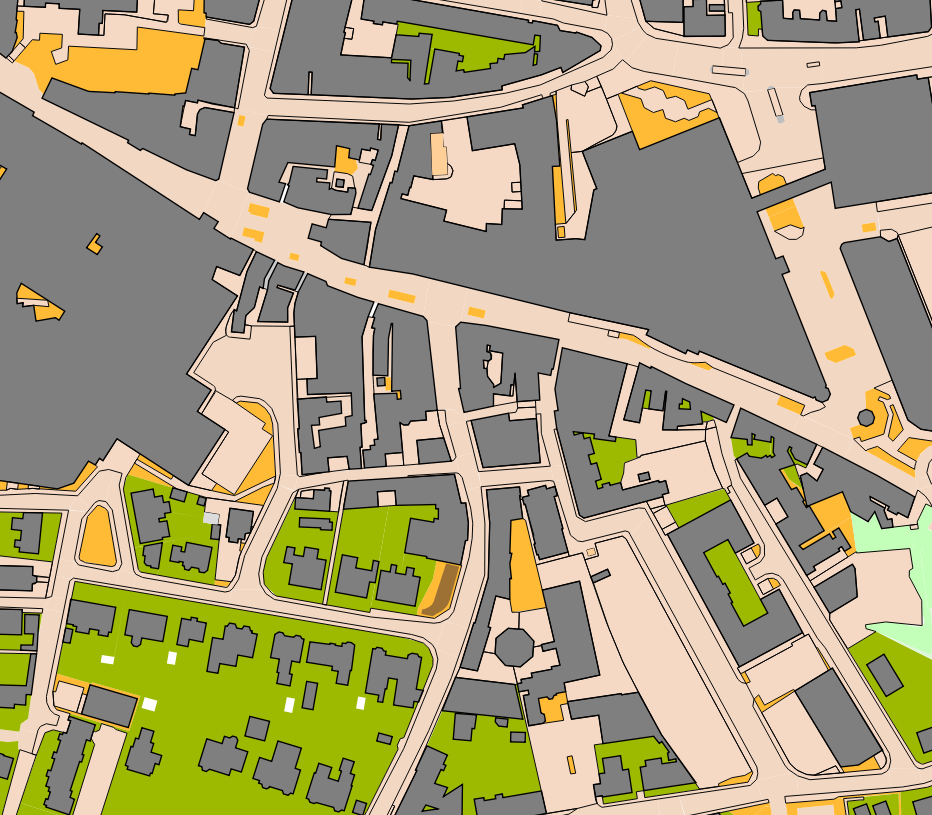
Most of the narrow alleyways are below the minimum width. Some big impassable walls are missing. There are lots of too-narrow strips of colour. An overhead canopy is shown as a solid building.
After the event had happened, my friend Joe showed me a auto-generated map that he'd made for geeking purposes, which was considerably better than Graeme's.
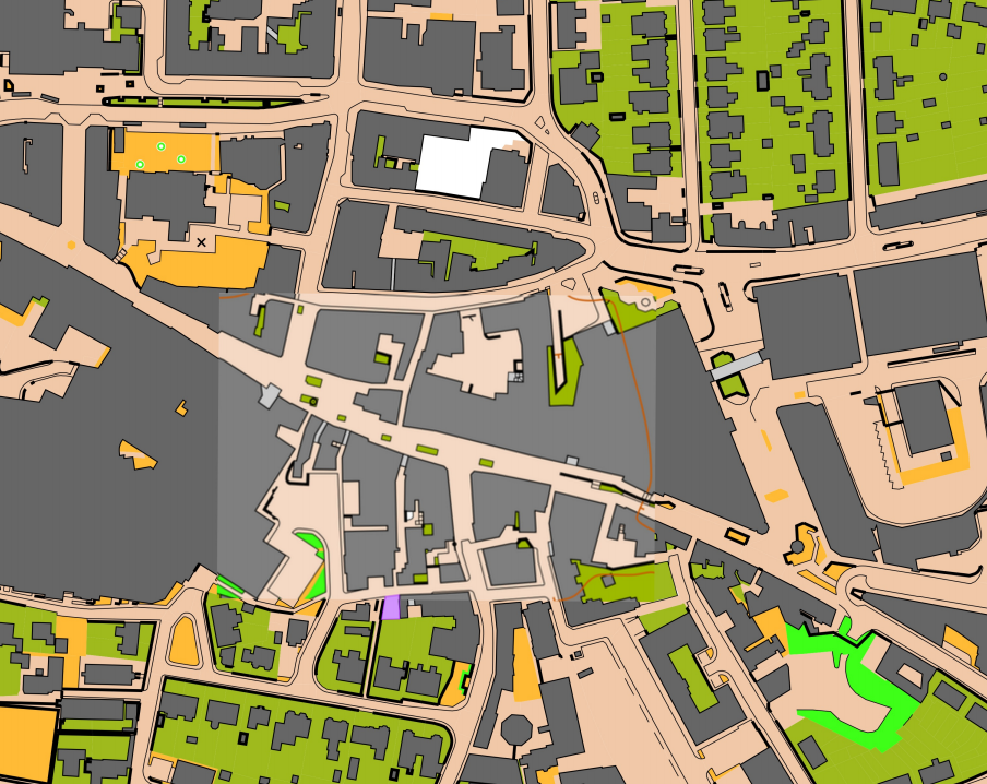
He'd even superimposed the map extract we'd released on the website! More of the main walls are shown, canopies are more accurate. However, there are still many places where strips of colour are too narrow and a few inaccuracies (e.g. the west side of the church and the passages through the bus station). And most importantly, mapping decisions have already been made for you, and despite your best efforts it is always easier to stick with a decision that has already been made, rather than change it. Auto-generated maps may be improving enough to be used at some point in the future, but for now I think I will stick to manual drawing.
However, for less important events, for example a local street-O league where competitors can forgive a 'bad' map (or are inexperienced enough not to realise) auto-generated maps are obviously more time (and therefore cost) efficient. I do think though that maps made using these methods should say so in the small print.
The other major issue for me was how we would combine the new map of the town centre with the existing maps of Callendar Park and Hallglen, which we wanted to do so that the longer urban courses could use the intricate estate of Hallglen. Callendar Park was a ISOM (i.e. forest) map, and both maps were a few years old and had slightly different magnetic north angles (look at the scale bar in the photo below!).
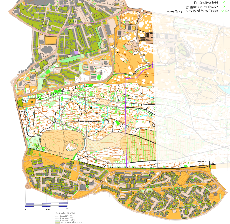
We would also be making some major adaptations to the Callendar Park map so that it was suitable for an urban event in September (i.e. the actual forest, off the paths, should be near-enough out of bounds!). Rather than try some kind of symbol conversion and re-scaling from the ISOM map to a new ISSprOM map, I decided to just re-draw the contours (adding in intermediate ones for the new 2.5m interval!). After that I copied over the paths but almost none of the detail in the terrain, deciding that it wasn't needed if competitors never left the paths.
Hallglen was already ISSprOM, though not the latest version. So I updated it to the new symbols and otherwise just copied and pasted (literally) it into my map. The boundaries were a bit fiddly to join up but otherwise it all worked ok. Here's the finished version: