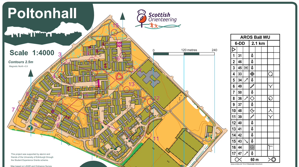
Poltonhall for AROS sprint relay - start to finish

What do you need to go orienteering?
1. A good area
I was sitting at a EUOC pasta night when my friend Jim and I got onto the topic of whether there were any decent sprint O areas in the Edinburgh area that hadn't yet been mapped. So, we opened up the OS map and had a quick hunt around. We found a few decent housing estates, and Poltonhall, near Bonnyrigg, was one of them.
- A map
So, we got in touch with Fiona who oversees new EUOC maps, and suggested it as a good area. She agreed and I got on with making the map!
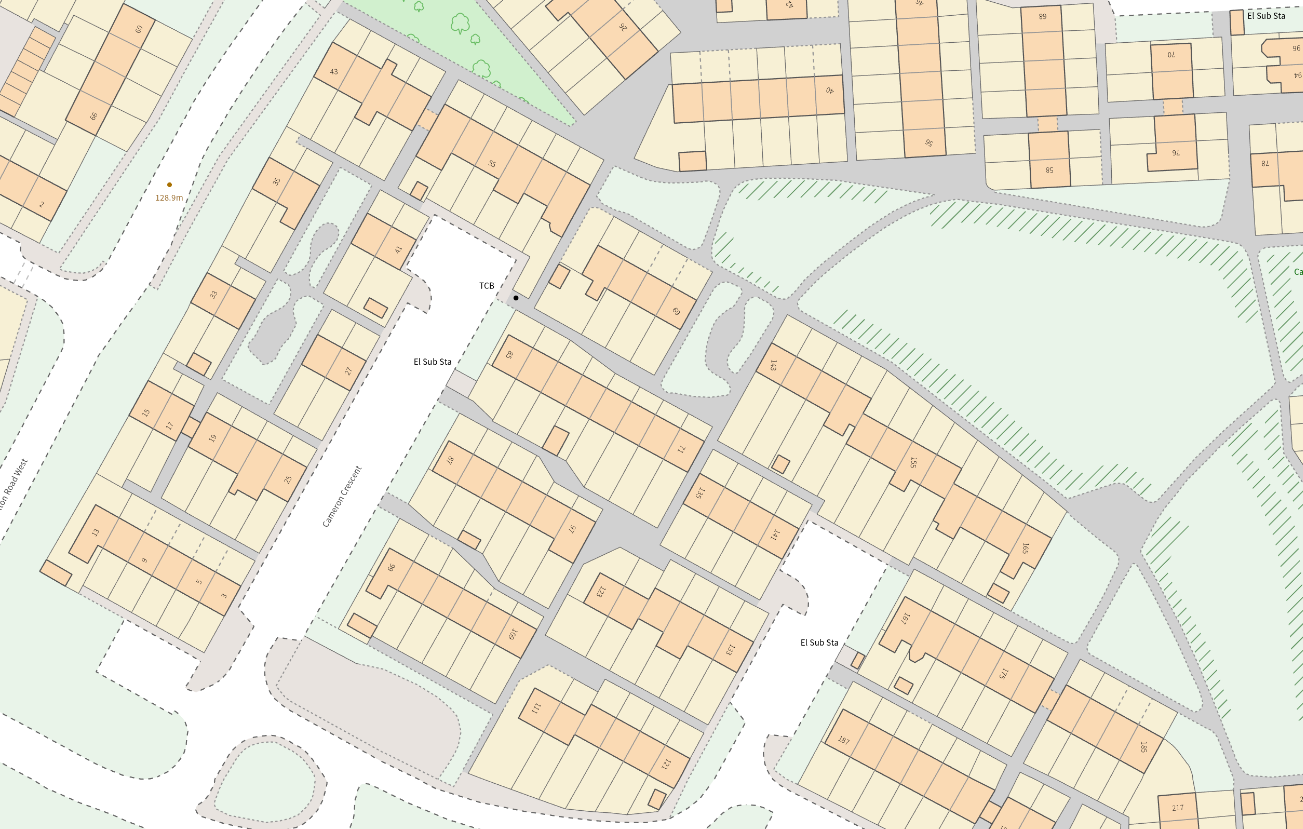
The OS map, as ever, was the starting point. The first job is tracing it out, taking care to preserve minimum separations and widths by enlarging alleyways and paths. A couple other differences from an auto-generated map - omitting sheds, and any pavements that just run parallel to the road.
I also realised fairly early on (from Streetview) that across this whole housing estate the front gardens consistently had low fences or walls (which it's normal to use a thin black line for when they border olive green) and the back gardens had 7-8ft high fences or walls, which I generalised with a thick black line for all of them, not bothering with tags on the fences, which helps make the map simpler and clearer too. The next thing is contours, where we can use LiDAR (and the associated Slope Gradient), after processing in OCAD:
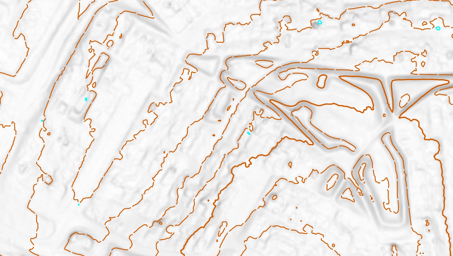
We "trace" every 5th contour, with significant leeway for smoothing and avoiding messy interactions with our (already drawn) buildings, roads, walls etc, and do the same for the 2.5m contours in between, often taking significant features from the 2nd or 3rd LiDAR contours and showing those. Next is another aspect of the LiDAR, the Vegetation Classification:
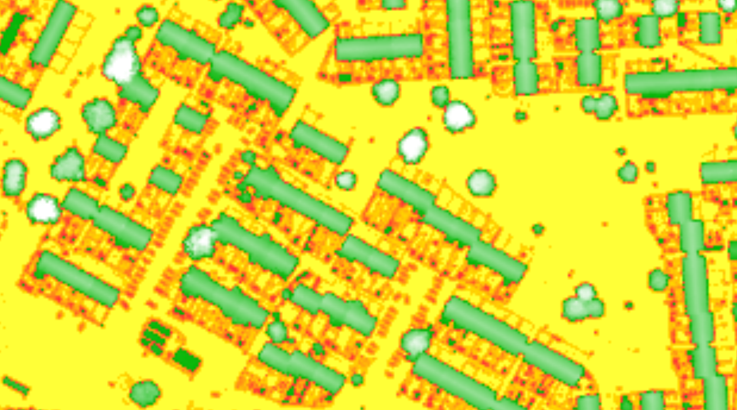
This is mainly useful for trees, though you have to be a little careful when the data is a little old (2020-21 in this case) as some trees will have been cut down since then! Some you can catch on Streetview, others while doing the fieldwork.
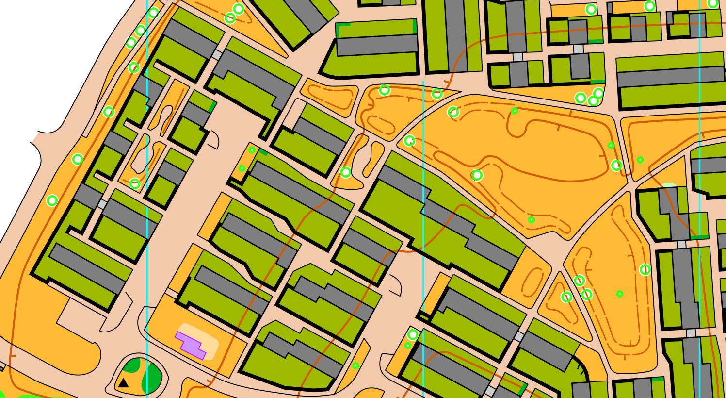
Fieldwork for an estate like this is fairly quick, just one visit, and the main things I was looking out for were: any trees cut down, any anomalies in the front garden / back garden fence heights, any obvious hedges to add, and checking the contours made sense. Post-fieldwork there is some tidying up to do, like adding north lines (and cutting them over narrow alleyways), colouring in all the tarmac, and doing the "layout" - title, scale, logos etc.
- An event
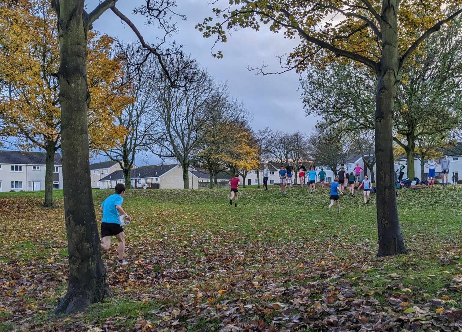
Arguably this should come before making the map! Anyway, we had the annual AROS ball approaching and thought that putting on some fun informal orienteering before the ball would work nicely. We settled on a 2 x 2 mixed sprint relay and thought this area would work perfectly for it.
- Courses
There's something rather nice about taking a map you've just finished and putting it straight into Condes to start planning some courses.
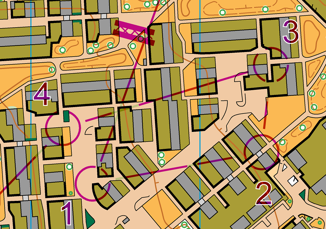
A few little things to remember for good quality sprint courses:
- Cut control circles and course lines when they obscure alleyways or uncrossables.
- Make artificial barriers clear and obvious (more than just a single purple line)
- White border on control numbers to help make them more obvious, and position them so they don't obstruct any important map detail.
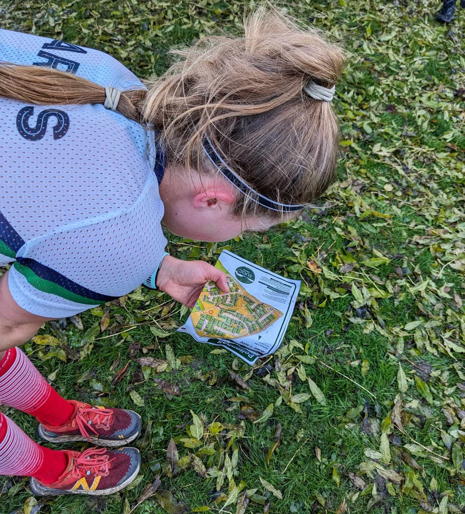
- Put on the event!
We printed maps (decent quality if you can), decided to use markers for controls but not bother with SI timing. Very informal, just a big bunch of friends enjoying some friendly head-to-head competition without caring about the final results.