Exciting stuff in the works

...and a big thank you to the Orienteering Foundation!
In one month's time I'll be in the Italian Dolomites for the IOF Young Leaders Academy, which I'm really looking forward to. It should be a great opportunity to work with other young people on developing the sport, with guidance from advisors and coaches from the International Orienteering Federation (IOF). There are participants from all over Europe (and a couple from Egypt!) so we'll have the chance to discuss what is and isn't working well in each of our countries and hopefully feed that back into the UK and my work.
The way the IOF is pricing attendance at the Academy is variable by country - with big subsidies for poorer, smaller orienteering nations and with the richer and bigger orienteering countries paying the most. Therefore, I'm delighted to have been awarded a grant from the Orienteering Foundation to go towards attending. The Foundation takes donations from the UK orienteering community and offers grants for developing the sport, so I really appreciate their support. I'd also like to thank my local club, East Pennine OC, for a contribution too.
There's plenty in the "work" pipeline too, I just can't say too much about it because the events haven't happened yet! Preparations for Sprint Scotland are well under way, and as well as being overall co-ordinator for the weekend, I'm also making one of the maps - Falkirk. It's a new map of the town centre, so I can't share too much beyond the map snippets we've publicised on the website. There have been some other mapping challenges too, because for the longer courses we're combining the new area with two existing maps, one of which is a patch of woodland which I've had to adapt from forest spec. (ISOM) to sprint spec. (ISSprOM).
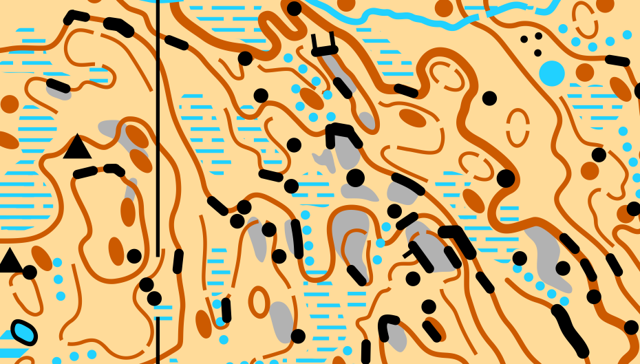
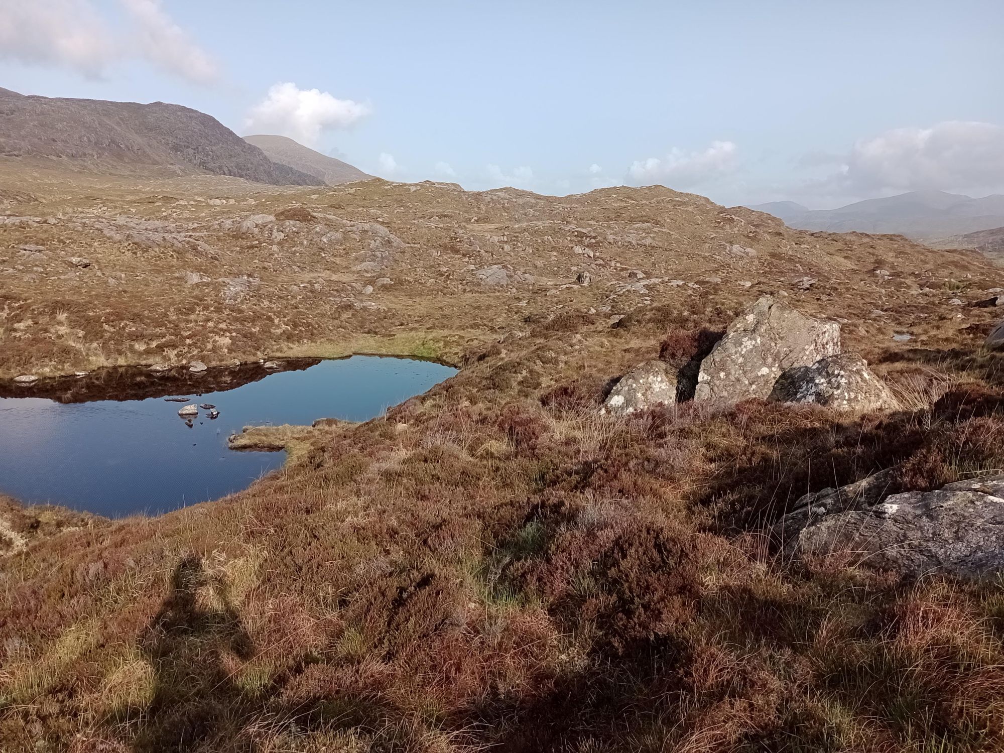
I've just returned from a trip to the Outer Hebrides preparing for Coast & Islands. I already made one of the maps in October (Wild and remote - Scalpay) and this time I had a few more jobs. First up was finishing the other half of a map called Cnoc Na Cloiche, to be used on Day 1. This area is the only one without LiDAR, which makes it significantly more challenging to map well. The saving grace is the satellite image, which is georeferenced and has good enough resolution to see most individual boulders and the shadows of crags. Unlike Sprint Scotland, Coast & Islands isn't a World Ranking Event, so I've added a map sample up at the top of this article.
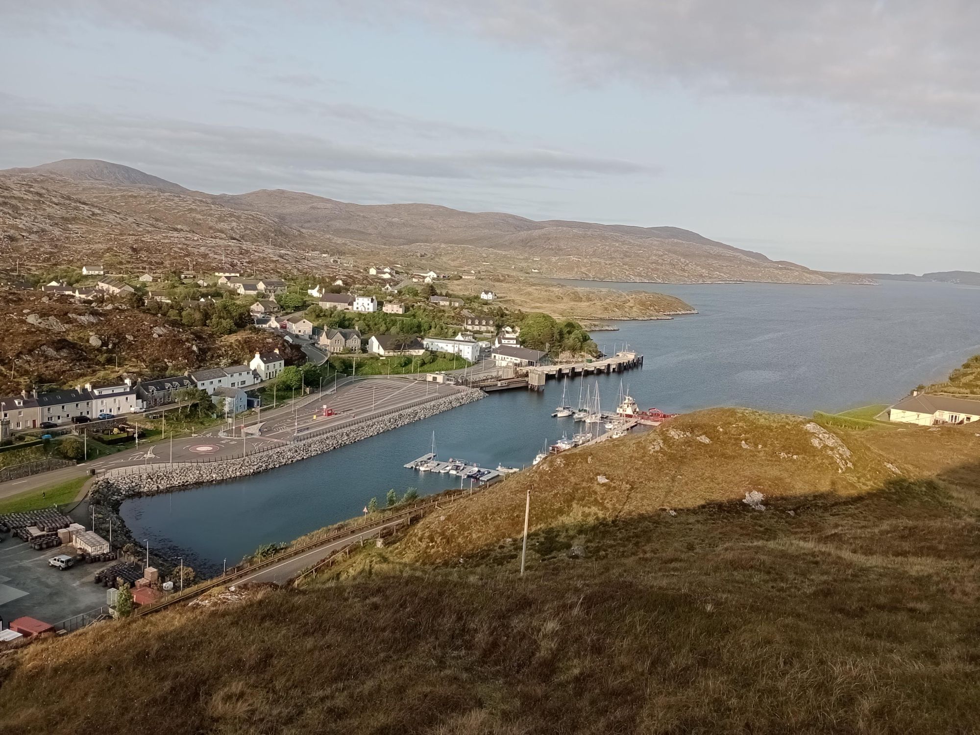
The second job was the urban section of Tarbert. It will be a combined terrain/urban sprint race and Martin Bagness (who I look up to tremendously in the mapping world) had already done the terrain section.
Next up was planning the courses for Day 5 on Torsacleit/Gleann Lingeadail. Since the area is open, I paid particular attention to the angles people will be coming into the controls from, and trying to tuck them out of sight behind hills, boulders, crags etc , so people see the feature first rather than the kite. We kept the courses quite simple, with just Long, Medium, Short and Orange, but it still took 4 hours to get round all the control sites, stopping, checking and adjusting controls as I went. As a planner you also have to put yourself in the shoes of an 80-year-old when planning the Short course, and I ended up adjusting this course to remove a section in deep heather and avoid crossing a steep ravine.
Hopefully our work during the week will result in an enjoyable week of orienteering for everyone coming!