A unique sprint - Tarbert

When we were scouting out Harris for Coast & Islands, we discovered that immediately adjacent to Tarbert was a cracking area of rock and contour detail, and so came the idea to have a combined terrain/urban sprint.
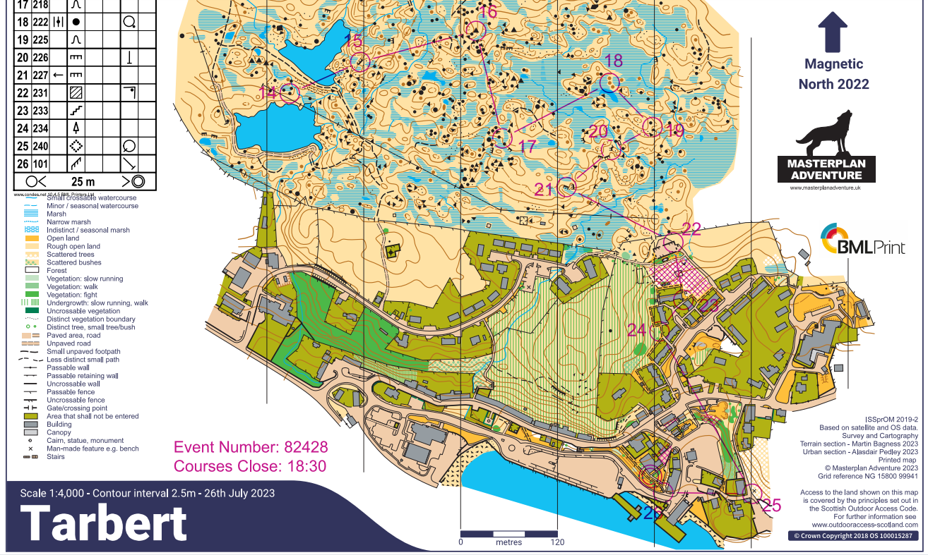
I had two jobs for this stage - mapping the urban section, and then planning courses (as a joint effort with Chris). Martin Bagness had already mapped the terrain half (his comments below*), and given we didn't use too much of the urban section in the end I'll keep my mapping bit brief. As usual, the starting point was the OS MasterMap, and supplemented with the satellite image, contour data and Google StreetView. The contours were similar to Cnoc na Cloiche, not the super accurate LiDAR of Days 2, 3, 5 and 6, but for the urban area that isn't such a pain. There was the odd surprise - the harbour has undergone significant building work in the last couple of years, so that needed to be redone! The last thing I should say is that the terrain sections within the "urban half" I intentionally left pretty much blank as they are quite rough and we knew we wouldn't use them.

Martin's comments:
This was proper old school mapping, i.e. virtually no base map and back to the black arts of yesteryear. Chris emailed an airphoto to use when I was already on Harris. The community centre printed it out, but at such poor resolution that most of the detail was lost. So it was back to a bit of compass, a bit of pacing and lots of looking, sketching and rubbing out. First to create the contours - then to fit the rock and marsh onto them - wrestling with shapes and levels - just like the pre-lidar dark ages. This all filled a long, damp, windy day. The day after I stuck a fresh sheet of film over this, went back and did a quick second pass - mostly adding or removing boulders (total number remaining at about 250!).
Onto the course planning process:
Chris made some draft courses, then I did the control site checking, thinking about approach angles and adjustments, for the terrain half of the map, which in the end we used for the majority of the courses. The picture below is a little confusing because we'd forgotten to print an all controls map, so let me explain. I used a Long part 1 map and drew on the rest of controls to make an "all controls". A simple tick in a control circle means that control site was fine - an obvious feature and with the flag not visible from the direction of approach, so people see the feature before the flag. This is one of the main considerations in an open area like this (more on this tomorrow!).
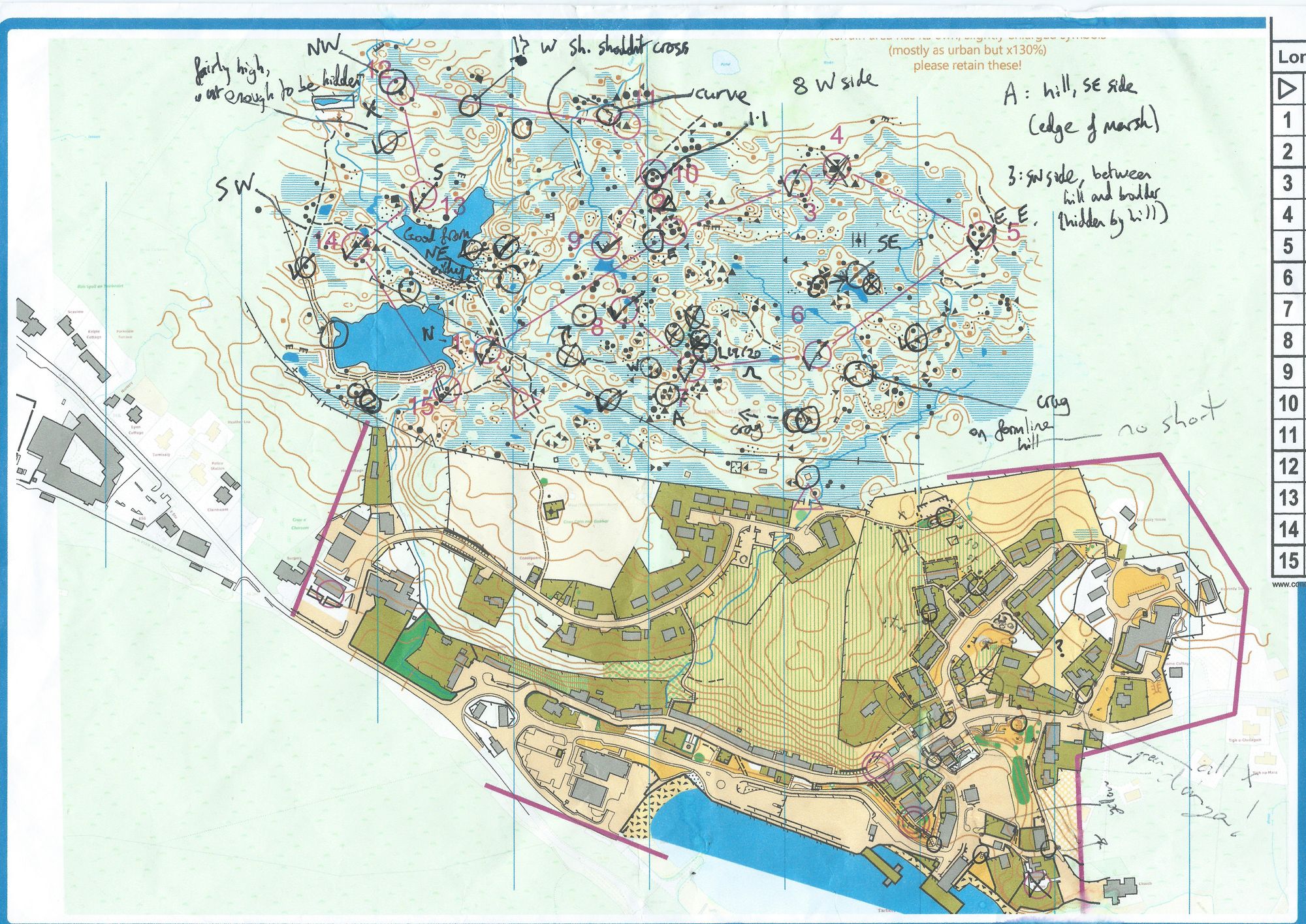
The arrows and freshly drawn circles indicate various adjustments I was making as I went along - mostly swapping out worse control sites for better ones. There were a few other things I noted down, like a stream in the north of the map, "Short shouldn't cross", because it was a little too deep and wide for older competitors. I had all 4 courses printed off (though two are double-sided), and using an A3 map bag you can have 4 sides of A4 paper visible at once, so I was constantly flipping between my "all controls" and each of the courses to check approach angles. The whole control checking process took a few hours.
Hope you enjoyed the event, the sunshine definitely helped. Tomorrow we'll have a slightly more in-depth look at the planning process!