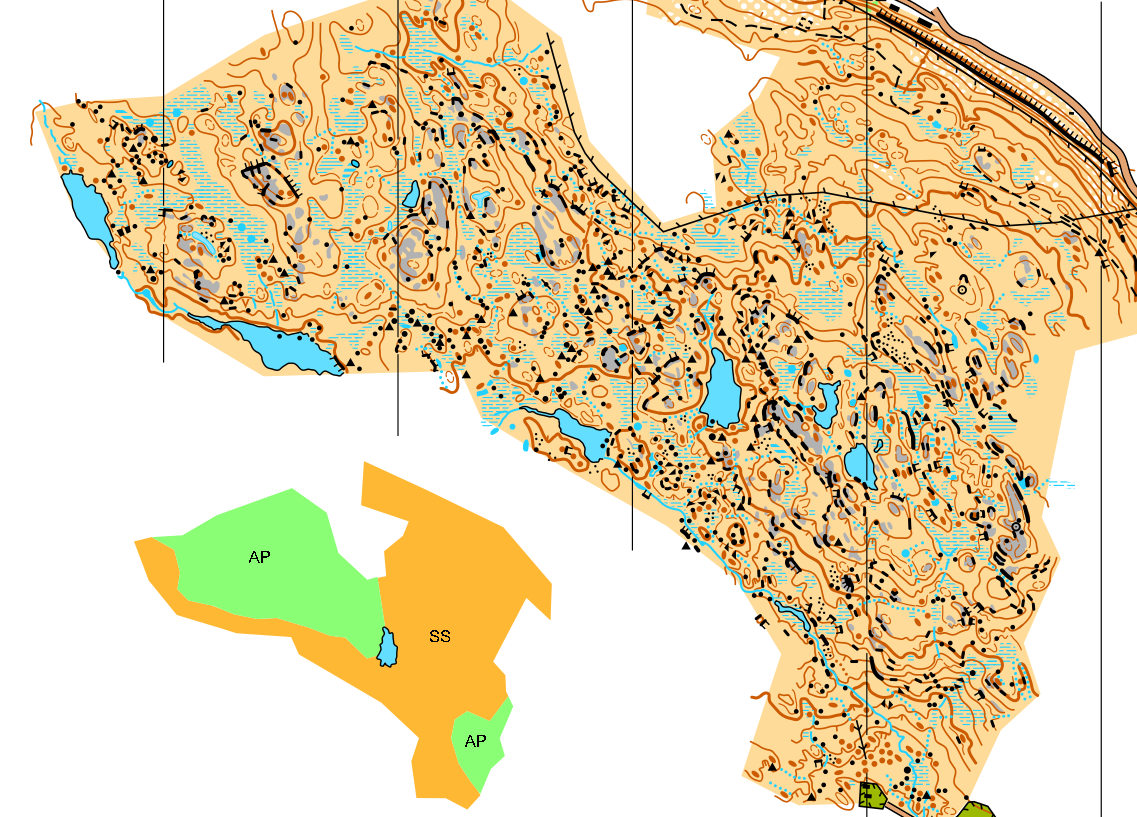
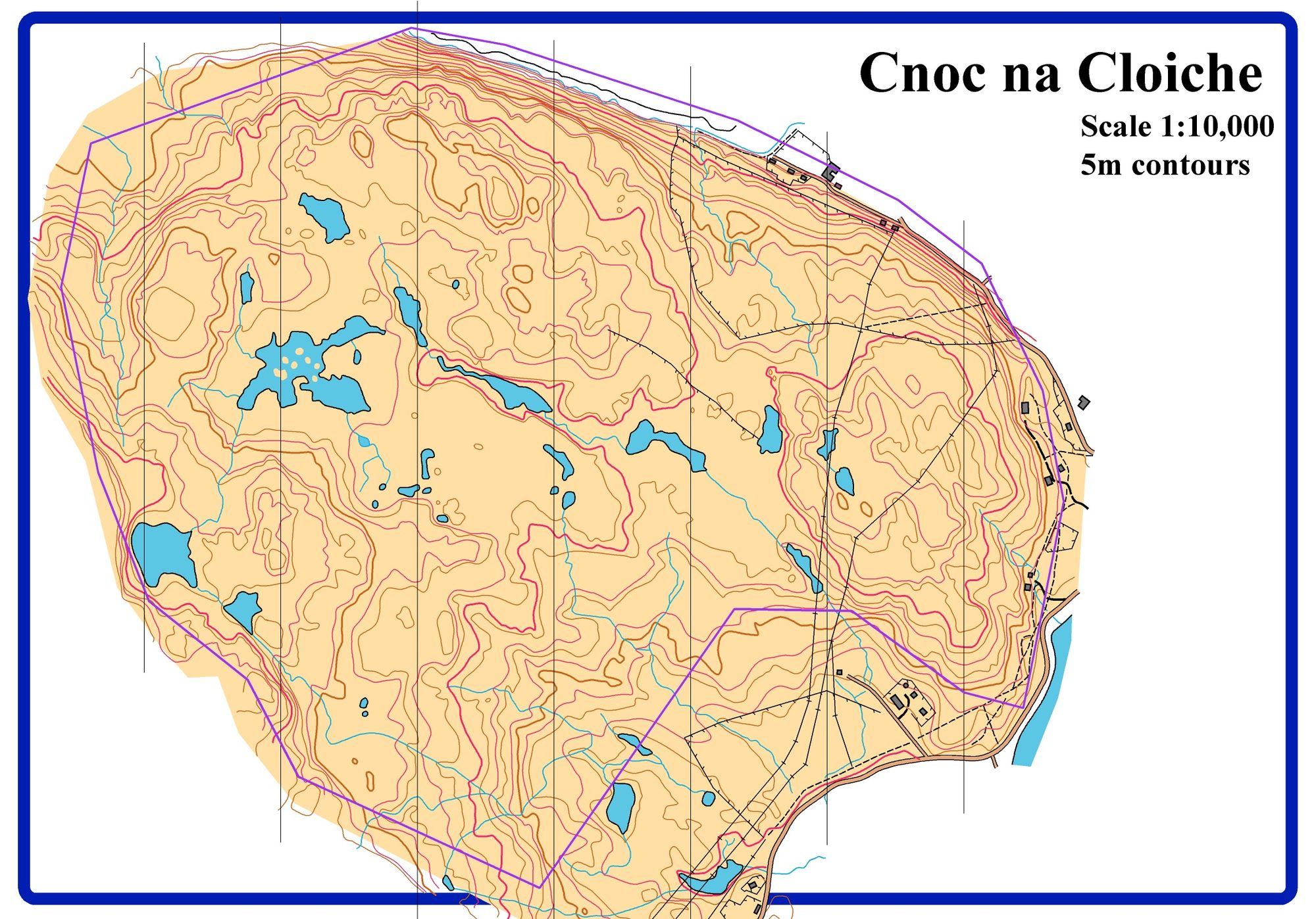
Cnoc Na Cloiche

So, did anyone notice the difference between the two halves of today's map? Here's the story of an unlikely collaboration between me and Steve Smirthwaite.
When Chris first asked me if I wanted to help make the maps for Coast & Islands, the first thing I checked was whether LiDAR data existed for them. At the time, as a very inexperienced mapper, the thought of making a map without LiDAR was scary. Chris assured me that most of the areas had LiDAR, including the one I'd work on first, Scalpay. One of the four main "forest" areas had no LiDAR, but Steve was doing this one. However, during the spring of 2023, other reasons meant Steve could no longer finish this map, and so Chris asked if I'd give it a go. I was assured some form of contours to use as a base did exist and with 6 months extra mapping experience I said yes.
This is how Steve described his part of the mapping process:
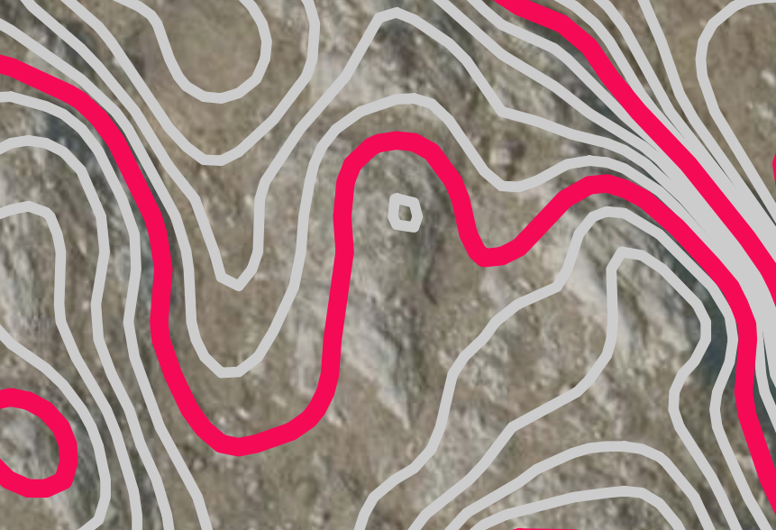
"This was the base map I nearly had to use - OS 10m contours with intermediate 5m contours sketched in"
However, we found something better, just in time...
"The image below shows 1m contours produced by computer from digital photographs. I did not know this was possible until I spotted it was available for purchase from the Bluesky website and made a few last minute enquiries. It arrived by email 3 hours before I left home to catch the ferry to Harris and it turned out to be a game changer. Suddenly we had almost lidar quality contours to work with so we could produce a much more accurate map in a much quicker time. I mapped for 2 glorious days using OCAD sketch app on a tablet [whereas I use the OOM app on a phone], with contours and a high definition aerial photo in the background. I had a good position reference from an accurate gnss system [Steve's super-accurate GPS!]. On the 3rd day the weather deteriorated and I managed some hardcore surveying before setting off for home." - Thanks for the comments Steve!
I'm not sure I'd describe them as "almost LiDAR quality"! The contours Steve ended up drawing looked significantly different to the base contours in places. More detailed, but also completely translated occasionally, which made me nervous.
But once you go to the area and spend some time getting familiar with it, a way forward emerges. There is usually more bare rock on the tops of the hills and sometimes a slightly different type of vegetation grows in the (wetter) reentrants and valleys. Coupled with a few shadows, this gives you enough to start seeing the satellite image in 3D. Finally, combining this new viewpoint with actually looking around and thinking about what shape of contour best matches the terrain, you can draw your contours with some level of confidence!
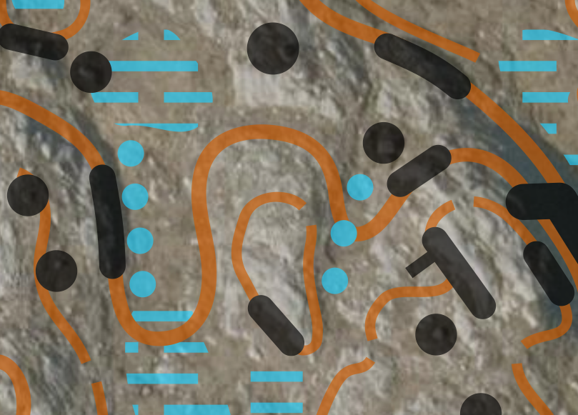
The (georeferenced) satellite image also allows you to pick out most of the boulders. If you look closely at the extract above, underneath the boulders you can see the grey spot + shadow that indicates a boulder on the satellite. However, there are also other instances of the same grey spot + shadow. These are likely to be boulders that I decided were too small to map. Also, compared to Scalpay, this time I was trying to be even more hard-lined on what counted as a crag, and tried harder to preserve the minimum separation sizes between crags (if you can get between them the gap should be at least 0.15mm).
I hope the differences in style between my sections and Steve's sections didn't hinder the orienteering experience, because there are quite a few! For example, I tried particularly hard to avoid "floating" crags - those which don't touch a contour, but Steve had used many. We both like including quite a lot of detail, but after reflecting on my Scalpay map I feel like I tried to simplify more on Cnoc Na Cloiche, thinking more about legibility. However, there are still things we both did which aren't true to the spec, like small patches of bare rock likely smaller than the minimum. In comparison Martin (Day 5) chose to omit them entirely.
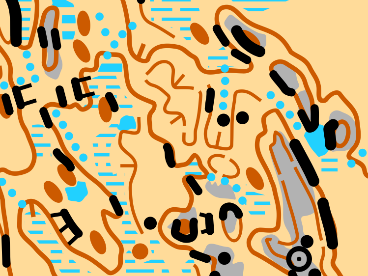
I'm quite proud of my section (excerpt below), though I'm sure I'll maybe look back on it in a year's time when I'm more experienced and think differently.
Anyway, I hope you all enjoyed it and are looking forward to the rest of the week!
For Coast & Islands people: this is my website, where I've been writing articles about all the mapping/planning/organising projects I've been working on. During this week I'll post articles after each day that I've been involved with (which is all except Day 3). This website also has the option to "subscribe" which means you get each new post in an email. So you'd get all this week's posts, and then future posts about my orienteering-related work in the future.