Scottish Spring - Kintyre
Planning courses for a Scottish O League in a great technical forest, and a little bit about organising the thing too...


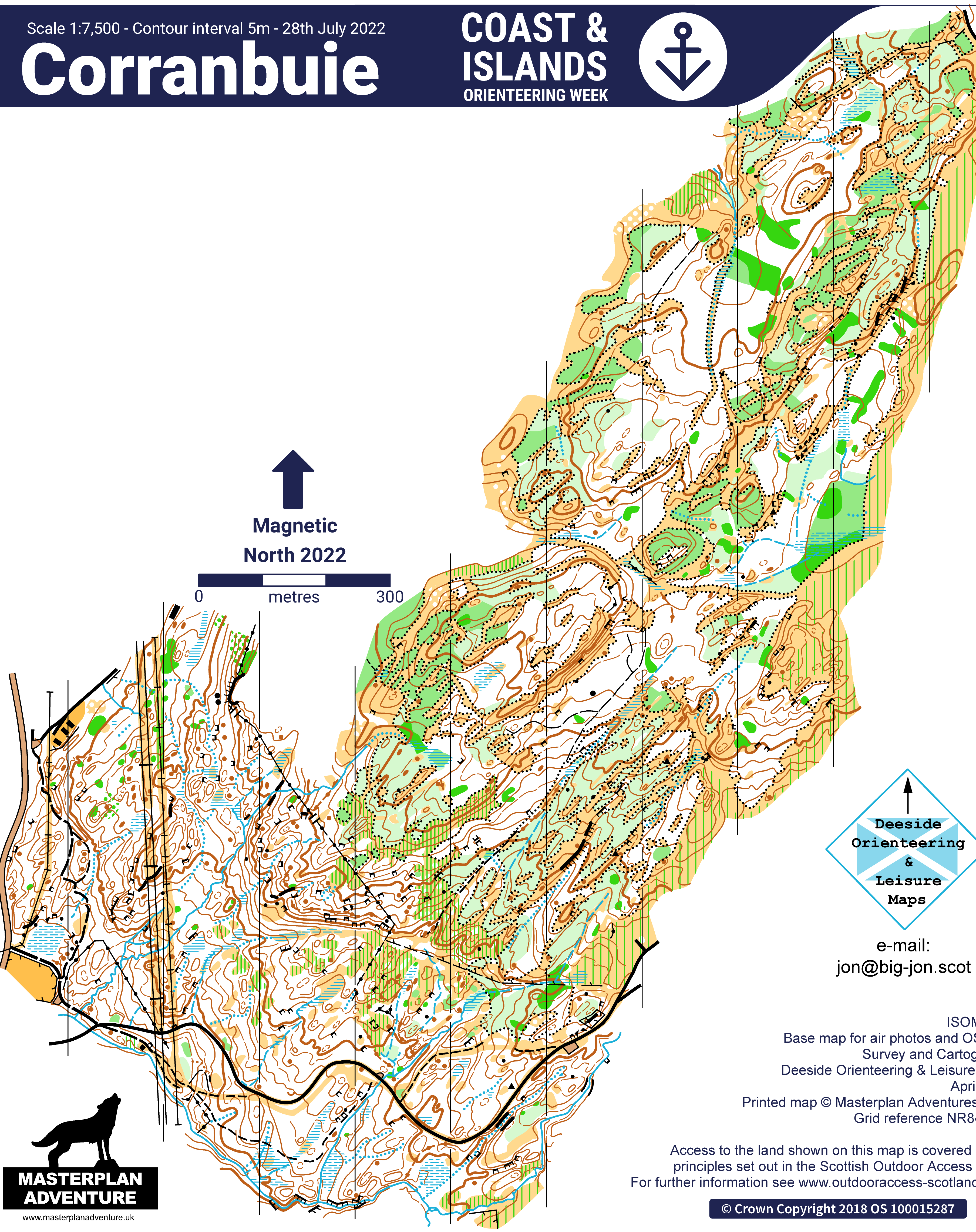
After the success of Coast & Islands 2022, which was possibly the first orienteering in Kintyre south of Lochgilphead, we've been itching to get back and reuse the areas there. Torinturk and Corranbuie lend themselves perfectly to a middle/long weekend combo, and we thought Tarbert Castle would make for a fun ultrasprint, particularly lovely on a sunny day (ho ho ho). Chris got the basics in place in the Autumn: An ok from the caravan park at Corranbuie, a word from ECKO that they could provide some on the day helpers, SOL status confirmed, Ross Lilley as controller, and convinced me and Mairi that we could be organisers! I sent off the forms to FLS for the forests and away we went.
We couldn't think of any prospective course planners to ask, so Mairi and I decided we could probably do that ourselves and in February we made a trip down to Kintyre to do it (big thanks to the Coons for letting us stay!) Mairi took the Torinturk middle and Tarbert Castle ultrasprints and I took the SOL, so I'll focus on that here.
The first thing I made sure to do was remove the narrow green stripes that marked the bracken, since our event was in March, not July. The different underfoot conditions also made course lengths a bit of a stab in the dark. I tried to use GG's runs at Coast & Islands as a marker, and from that decided the Black would be won at about 8mins/km straight line, given the faster Spring conditions. I was aiming for a winning time of 70mins so wanted an 8.7 - 9.0km Black, and scaled the other courses from that based on the tables, though making the shortest TD5 courses even shorter because of the steep slopes and tough terrain.
I'll focus on 3 courses here: Black, Short Green and Long Orange. Here are the first armchair planned drafts, from the start of February, before the visit, starting with Black:
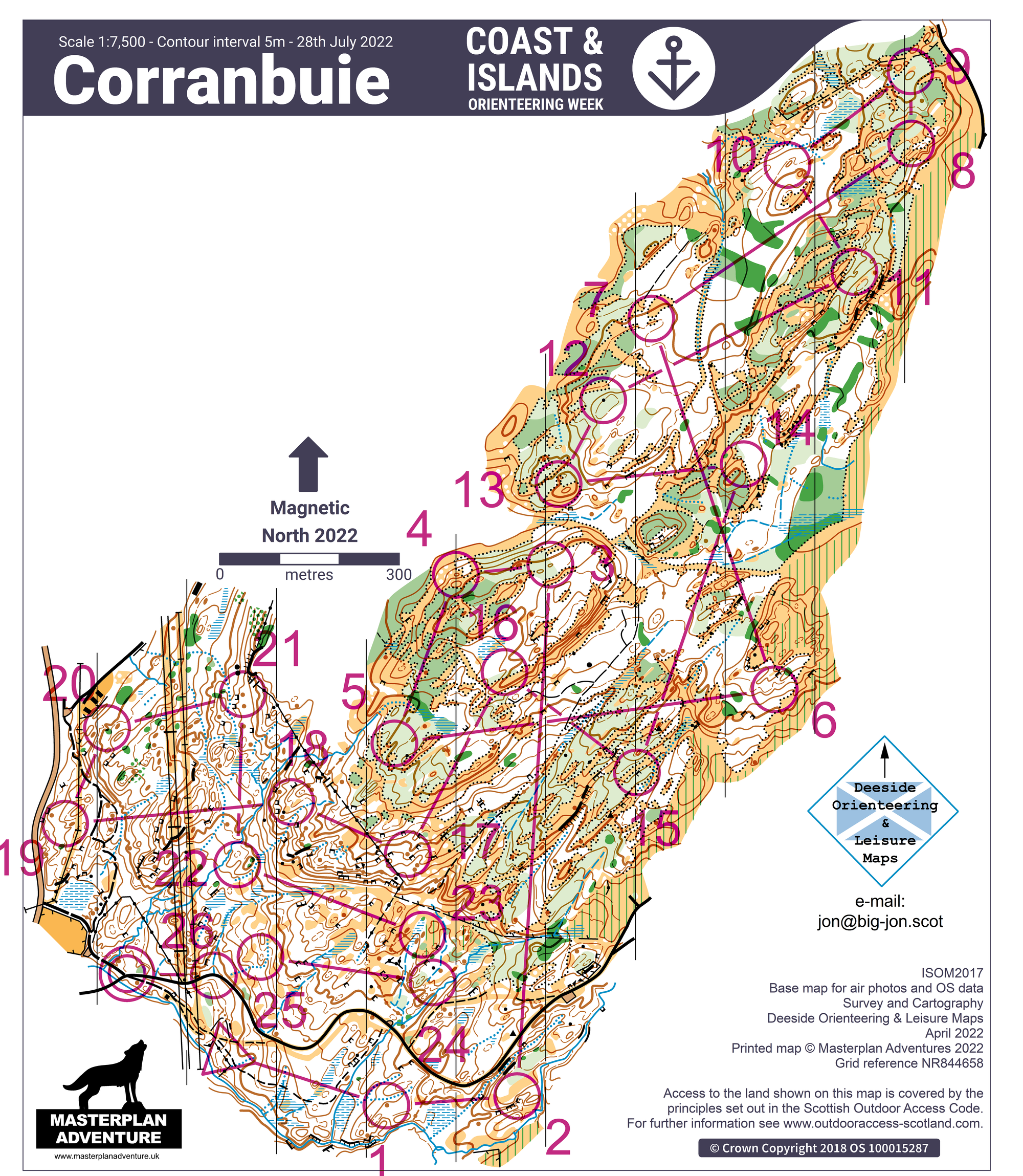
First of all, I settled on a start near the bottom of the hill pretty quickly for a few reasons:
- A section at the start through a nice patch of forest south of the track (Chris told me it was nice).
- Having them run up the hill added time and distance which I needed - I would have to use the full area to get in the distance whilst avoiding repetition.
- The only way to get a long enough White course was by sending them up round the loop of small paths/big track - they are the only viable paths to use.
- Nice short walk to the start from assembly.
I thought it would be possible to get a good course without needing a double-sided map, but it needed significant thought to avoid undecipherable purple spaghetti. The main philosophy was to have lots of legs diagonal to the lines of the slope (the main ridges/reentrants etc) so the longest legs would criss-cross the NE part of the area. In the end, 17 of the 26 control sites were good enough to survive to the final course.
Short Green:
The philosophy with the Short Green was to keep it in the nice oak forest below the wall/ruined fence that marks the start of the plantation. It was going to be relatively easy to make a course that was technical the whole way, so the focus was mainly on avoiding the roughest/steepest slopes. The BO webinar on planning for older competitors helped with this actually. I was still keen to get a longer leg in, possibly with the big craggy hill (that the pylons go over) as the obstacle to form a left/right decision, though the course above doesn't do that brilliantly.
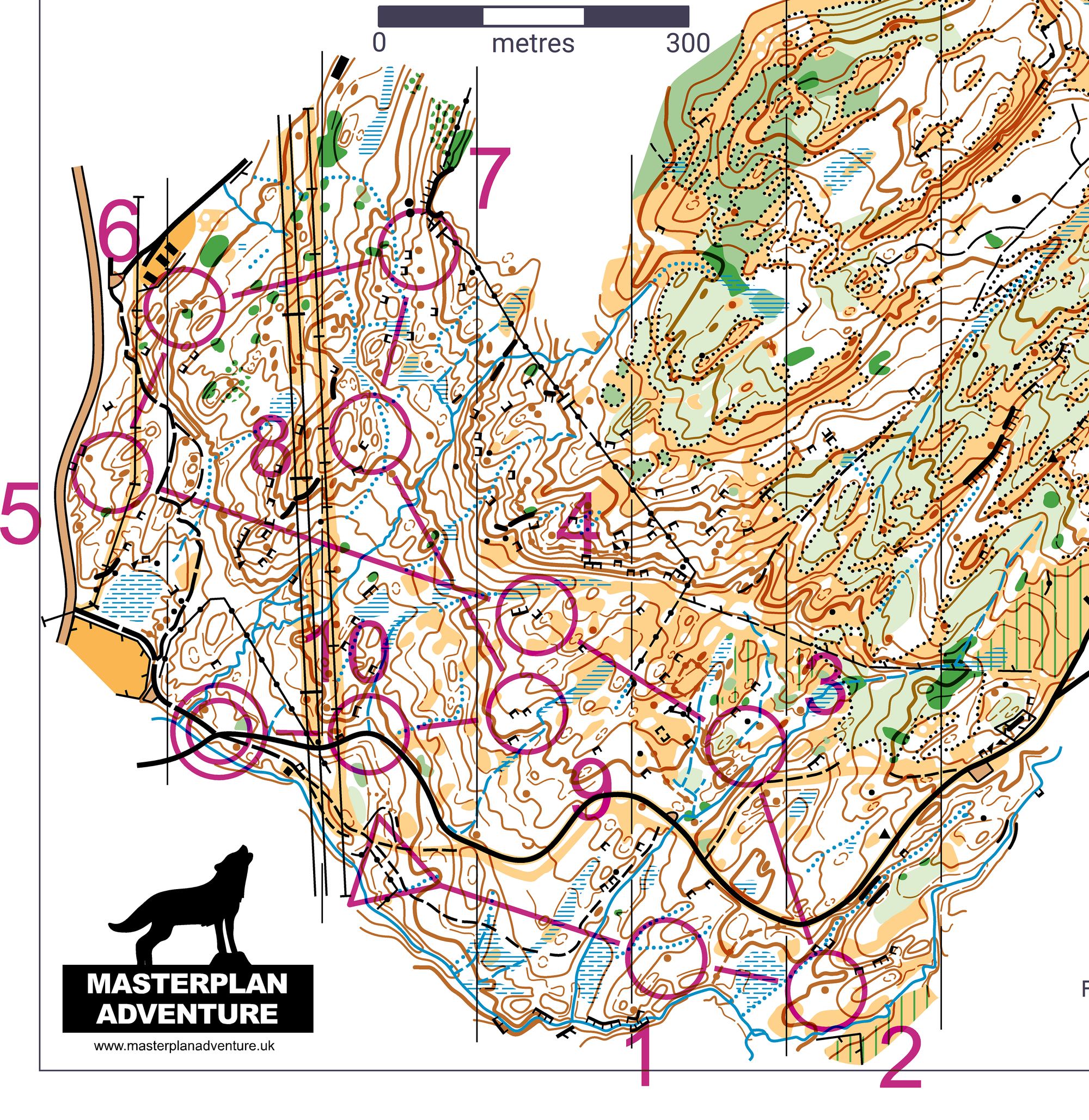
Long Orange:
The Long Orange was a tricky one. I knew Chris had had to think long and hard about where to send the Orange courses at Coast & Islands. There aren't many line features to choose from! Ross suggested exploring further NE on the forestry track, which I did (hence why they appear on the final map!) but they don't make a loop and the ground around them is pretty rough. I hoped the big reentrant where #5 is would be easy to follow down to the farm in the NW... I was expecting to be mapping the farm anyway as Chris said the holiday park were keen to have it. Unfortunately there is no LiDAR for any of the area, so new mapping was tough going - I had 1:25000 OS 10m contours, and the mastermap for boundaries, but otherwise working from nothing but vibes. I had 3 full days on the area, and spent at least half that doing new mapping. If I was filling in the reentrant for 5-6-7 then I needed to fill in the hole south of that too, but maybe that could help the TD5 courses.
Unfortunately, when I went to the reentrant to map it, I discovered that it was very steep and craggy - not ideal for novices to be following! The course shape needed a major rethink. The farm was usable though, and the owner of the holiday park was happy for us to use it.
So, fast forward to the finished version:
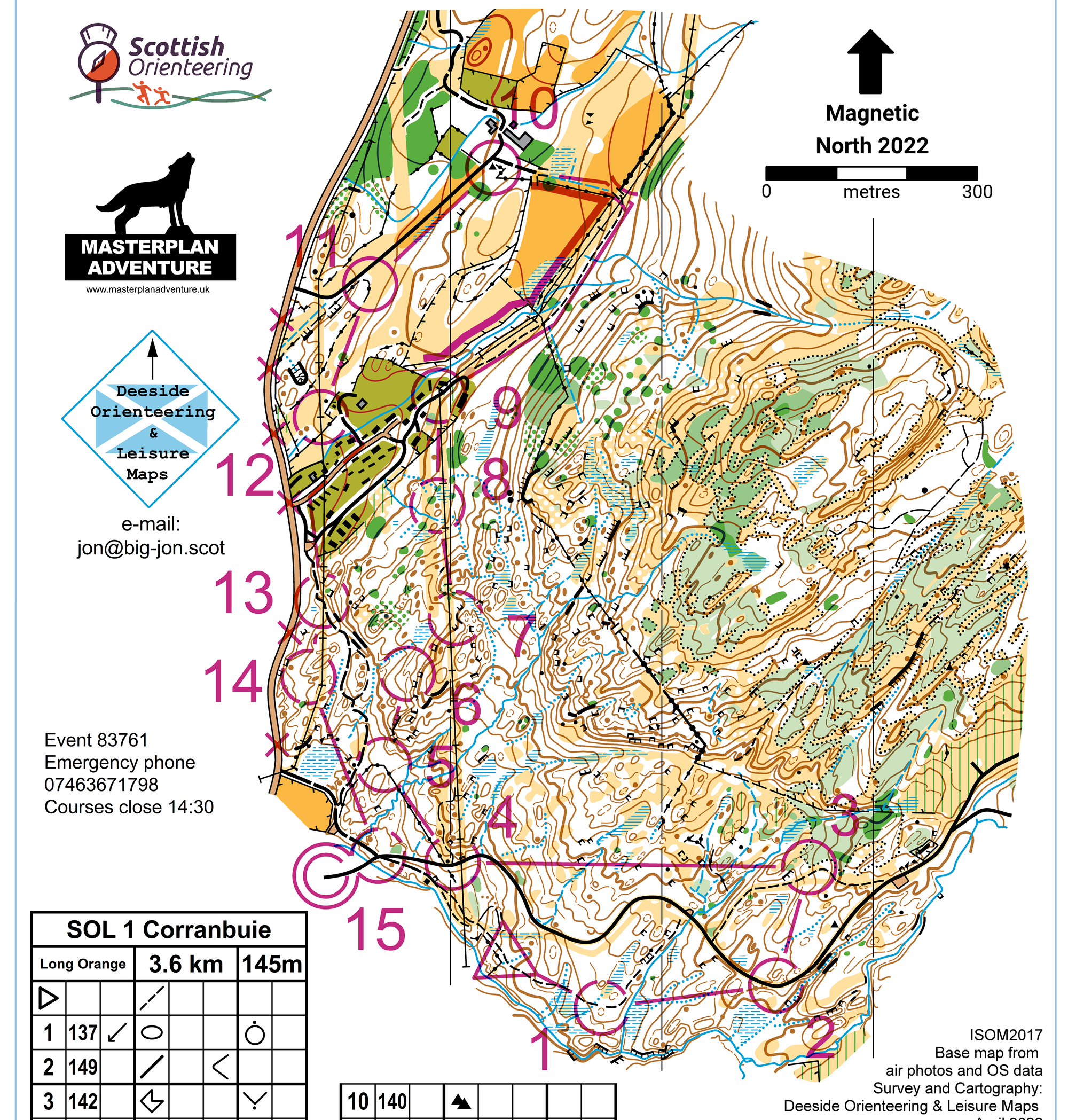
The mapping of the farm in the NW is pretty basic, but it does the job for this course - it gets in the distance with some nice TD3 legs. We had to avoid the main road, so brought it back through the caravan park. Getting from 3 to 7 was a topic of much debate between me and Ross. I thought following the pylons over the hill was sub-optimal because it was very physical and boring climbing the hill. For quite a while I had the Orange/Long Orange going to the fence/wall junction then following the bottom of the steep craggy slope, but then there was a difficult (TD4/5) jump over to #7, which I didn't want to tape because all the TD5 courses went through there. Ross suggested this option and I liked it, though in the end we decided 5-6 was still a bit hard and taped it.
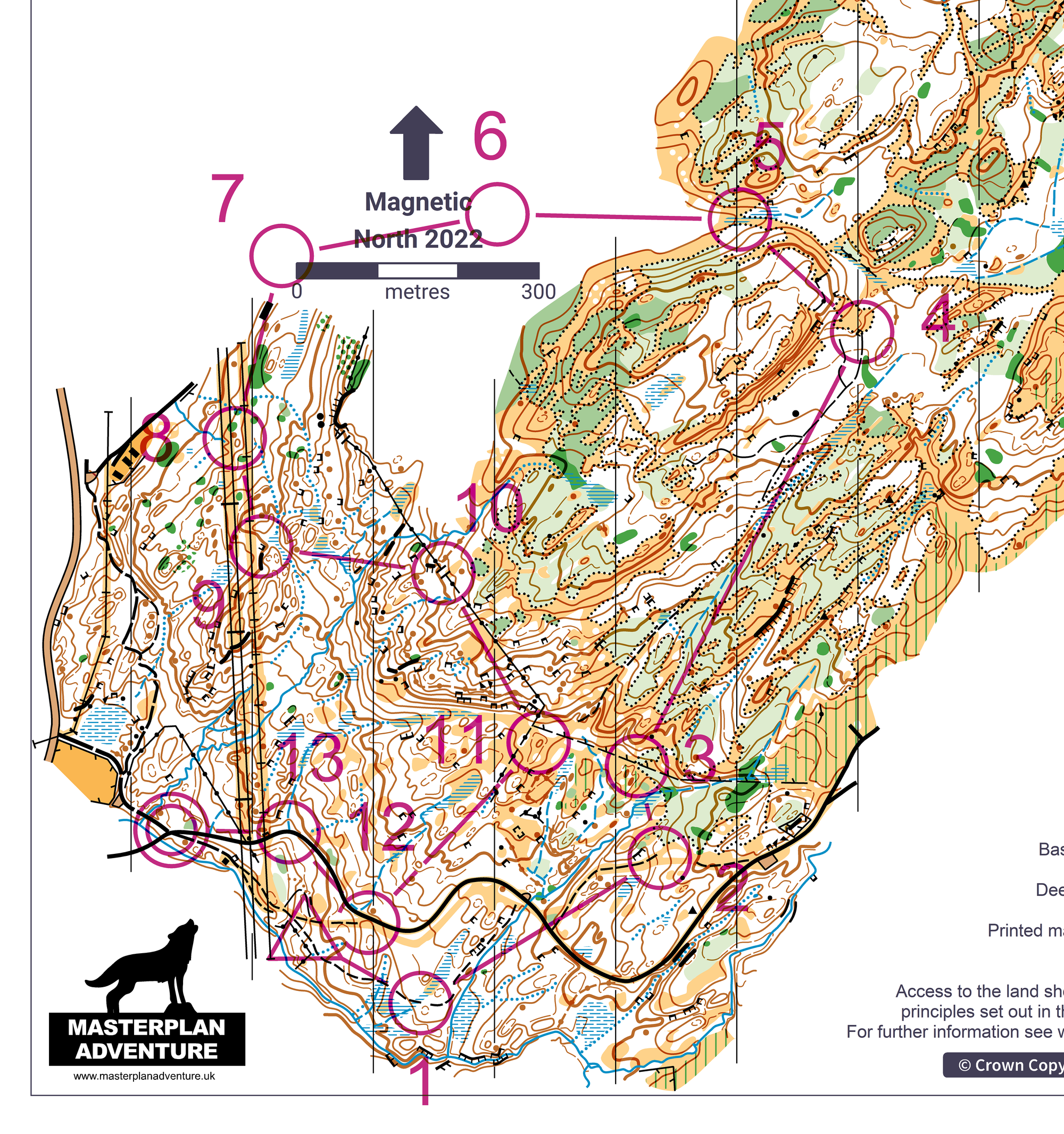
Now back to the Short Green:
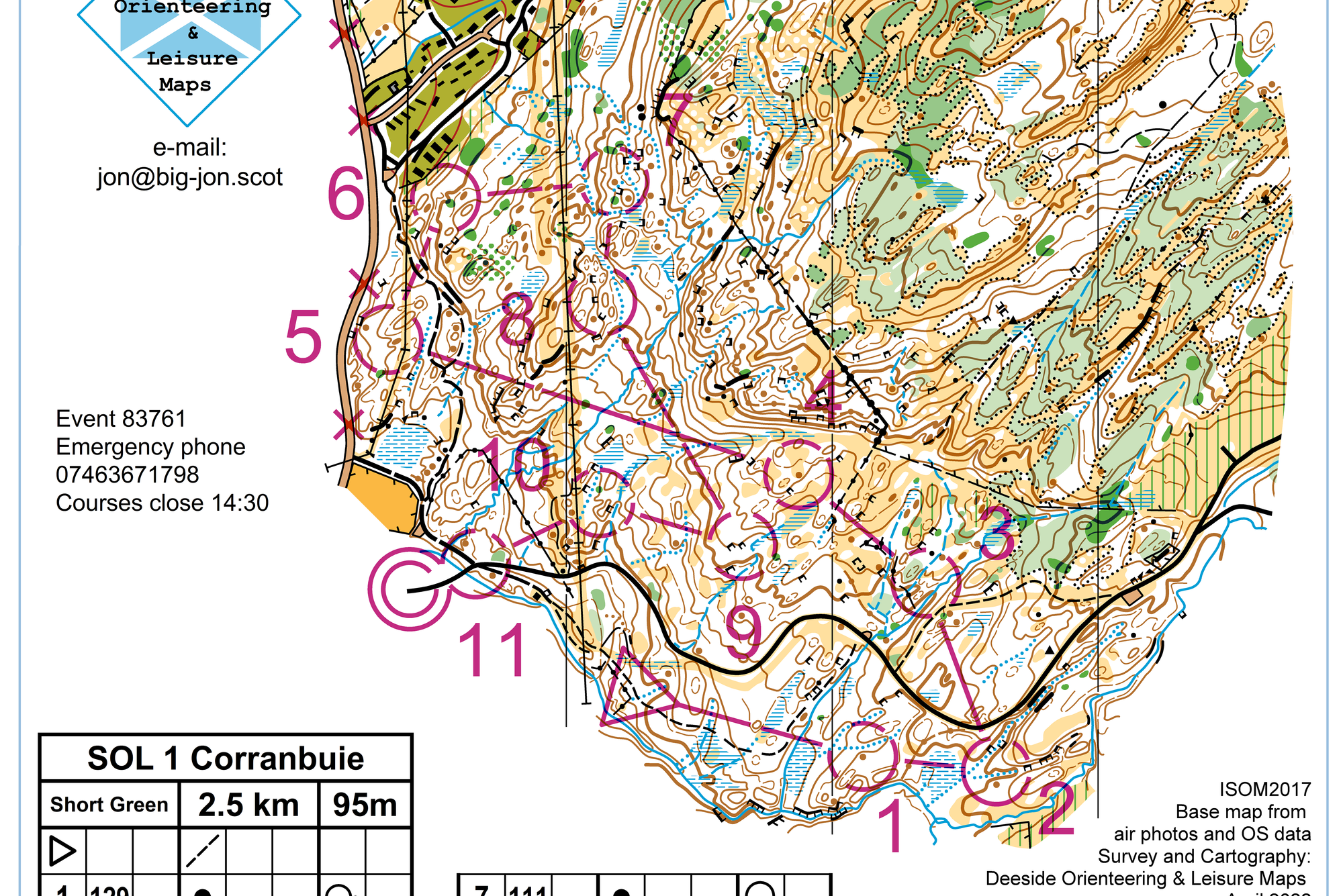
The on-the-ground work was a combination of checking control sites and tweaking the map. To edit the map I was, as usual for my mapping, using the OOM app on my phone. Each control would usually fall into one of four categories:
1. Site is obvious and fair, and there's nothing wrong with the map in the surrounding area to make it seem weird. All good.
2. Site can still be used with some tweaks to the map to make it match the feature/surrounding features a little better. I don't blame Jon at all for this by the way - I was very impressed by how he had managed to do what he'd done without LiDAR - but the areas just around controls needs to be as close to perfect as it can be for something like a SOL where people expect decent quality. This was the case for #10.
3. Site is too vague/indistinct/small to be usable.
4. Site is fair, but the terrain is a bit rough or hazardous and there are better options nearby. This was the case for #2 - the valley was steep and unnecessary to cross so I moved it to the small reentrant on the other side, and enlarged it on the map to make it readable. Also for #4 - the craggy slope was pretty steep on the ground and again unnecessary to send M/W75s down, so I moved it to the knoll and then they could navigate to avoid the craggy slope.
I thought the climb up to #7 was a bit gratuitous, especially because they came straight back down it again, so I moved that down a level to a nice knoll. The new site also worked from approaching from the SE as it would be hidden by the hill until the last moment.
Black:
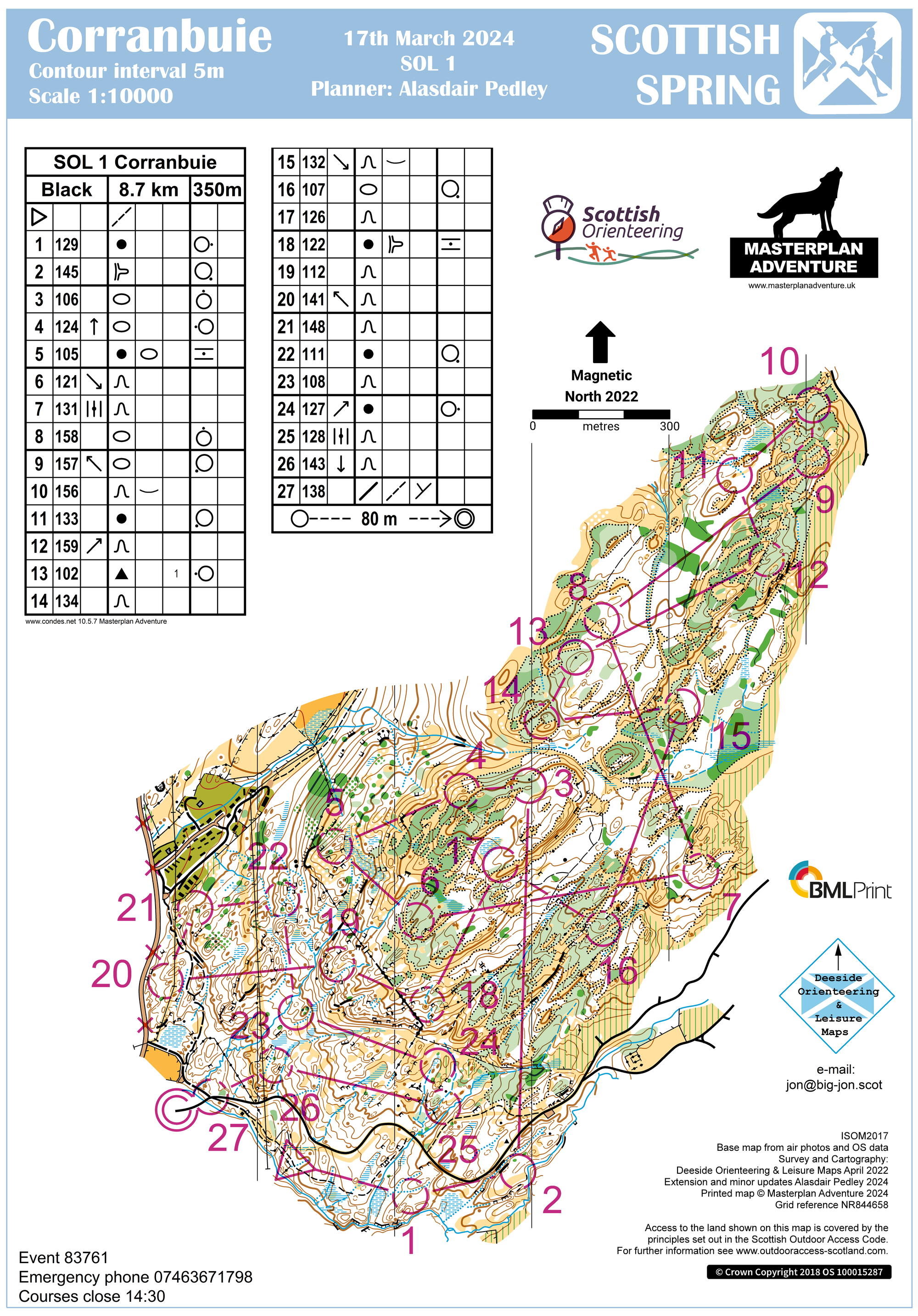
After another visit back to my new bit of mapping on the main map (the "hole" that I'd filled in) I was confident enough in it to send Black in there for one control. There was a nice hill with knolls on top that was a lovely control site. It also helped get it back up to 8.7km and few more contours climb after the reduction caused by moving #7 on Short Green which the Black also used
There were a few more instances of sites being too vague and often in these situations I removed/changed the original feature on the map, which I should probably caveat for any budding planners reading, is not normally a great idea unless you're quite confident/experienced. This was the case for #3 (hill removed - though added a boulder nearby), the new #8 (clearing too indistinct - removed distinct veg. boundary and moved the control to the hill), #11 (hill a bit non-existent so removed and moved it to the knoll), #16 (tried a few times to find the original crag and never did so removed it and put the control on an admittedly small hill but which had one steeper side which worked well enough).
At #2, I thought the craggy valley was a bit dangerous to put a control in, but this left me a little bit stuck with a big blank spur with nothing to put a control on. The streams were a bit TD3-ish I thought. So I found the most obvious thing I could which was a form line spur I could put on the map and use. Ross was happy with it and no complaints from competitors, so happy days.
For the weekend itself, Mairi and Chris were away on a GB sprint training camp in France so, not having a car myself, I was in a bit of a sticky situation. Thankfully Joe Sunley was happy to step in and help! Big big thanks to him. Suse and John Coon were also an incredible help in gathering ECKO helpers - still quite minimal numbers by SOL standards but just enough to get by (3 on parking, 2 people x 2 shifts on the start, Robin and Sheila (plus 1) on download covering each other's runs, me, Joe, Ross and some EUOC control collectors). Things went fairly smoothly organisationally and we put all the controls in the right place despite it being the first time for both of us in Torinturk (though not all first try - only after checking each other's efforts!). Lots of people gave us positive comments so that was nice, very few complaints, and the Black on Sunday was won in 70:51. Job done 😀