Bold Venture and Whitehall Parks

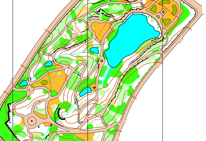
Another two parks for Pendle Forest Orienteers, supporting their efforts with the Find Your Way project and following on from Corporation Park which I mapped in January. Bold Venture and Whitehall are both Victorian style parks in Darwen, near Blackburn. They're separated by about a mile and have very similar feels and mapping challenges. The base map was the usual mix of OS MasterMap and LiDAR, and giving preference to the LiDAR for features like streams and ponds, which are also shown on the OS map but not as accurately - it's more reliable to say that a stream will follow the bottom of a valley, as shown by LiDAR.
Both parks are also quite steep, so I used 5m contours rather than 2.5m to keep some clarity - 'the value of white space'. However, given they are 1:4000 sprint maps, it does mean that the slopes may feel steeper than they look, and if in wet weather some would be challenging to get up!
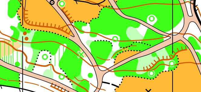
The most time consuming part of the fieldwork was easily the vegetation - deciding on where the transitions were between various levels of green, and trying to stick to consistent rules with them.
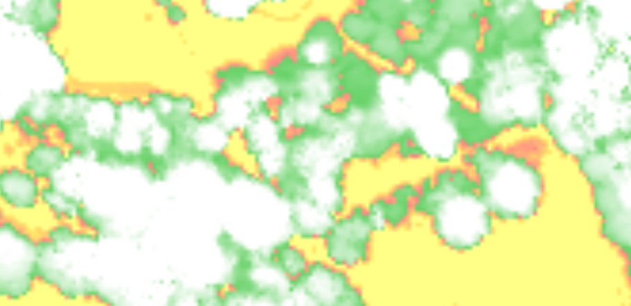
From the LiDAR data you can get a "vegetation height" map, because the LiDAR process can differentiate between the return signals reflecting from the tops of trees and those reflecting off the ground. It can be very useful for pinpointing a tree in an open area, or locating an obvious vegetation boundary, but within a forest it's hard to extract much from it. Here's the same section of map as above:
I'm looking forward to seeing the maps get used, perhaps for a two-part sprint race. They would also make great areas for beginners, such as those trying orienteering for the first time through Find Your Way.
This weekend was also PFO's North West Urban League event in Todmorden, using the map I updated earlier in the year. I was glad to hear the event was a success and that competitors found the map "clear and easily intelligible in the intricate areas".