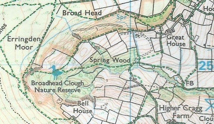
Broadhead Clough

I've always wanted to make an orienteering map of the nature reserve close to home and in summer 2022 I decided to commit to doing it - my first forest map.
It's a very small area, around 0.5 km2 , but full of contour, vegetation and rock detail. It's also managed by Yorkshire Wildlife Trust and includes Sites of Special Scientific Interest (SSSIs) so it is highly unlikely permission would ever be granted for an actual orienteering event, but it's good to get it done. It was also a perfect starting point for getting my first experience of forest mapping, and of using OpenOrienteering Mapper (OOM). All I had done previously was a sprint-spec map of my Sixth Form.
I traced out the walls/fences from the OS map. I could trace out the 5m contours too, but they are nowhere near as accurate as LiDAR data, openly available from the Environment Agency. LiDAR doesn't cover the entire country and you sometimes get gaps, which unfortunately included the Northernmost section of the area. This is the least interesting part of the map though, so not to worry. You need OCAD (or QGIS but that is more uncommon) to convert the LiDAR data into (1m) contours, but after doing so the raw data is jagged and messy in places.
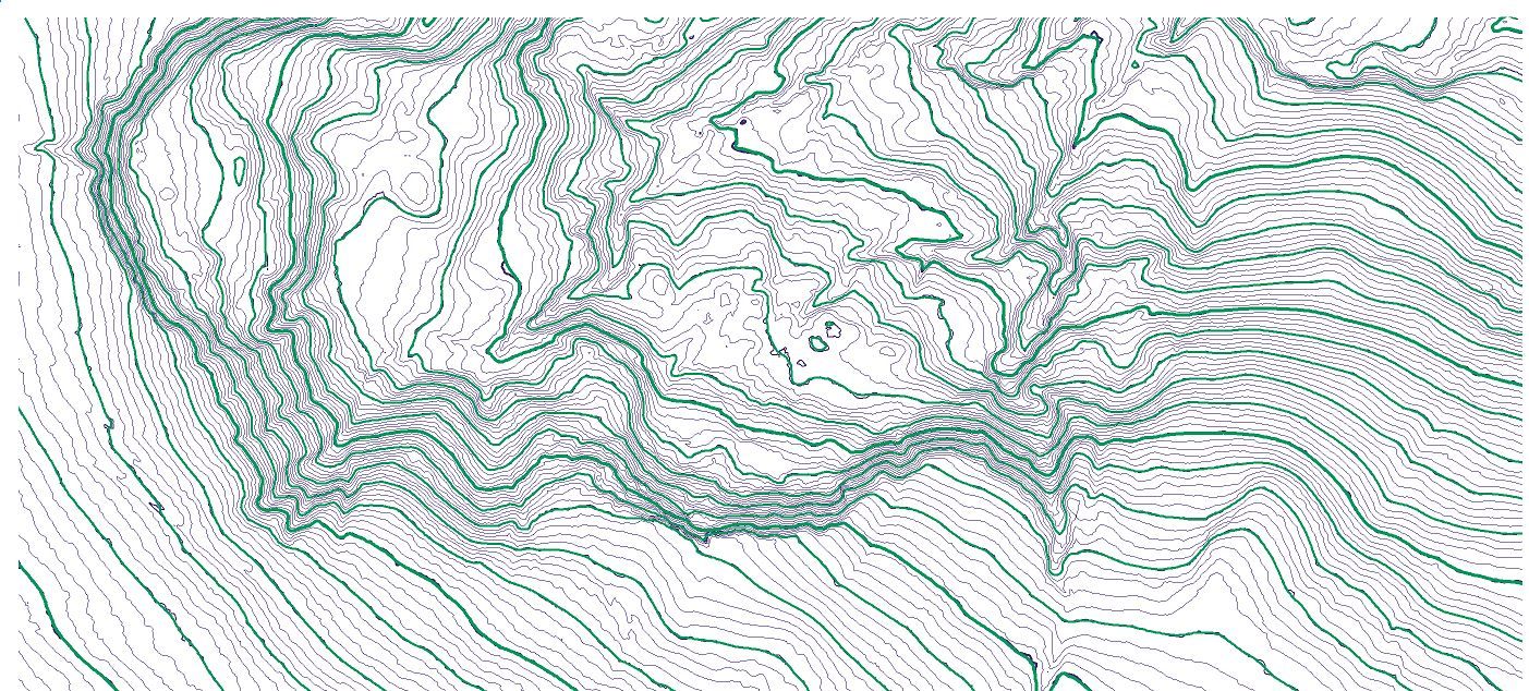
So, the first step was tracing out 5m contours from the 1m LiDAR data, using my best judgement for smoothing out the jaggedness, and using form lines to include obvious contour shapes which fall between the 5m contours. Due to the small size of the area, and the level of detail I wanted to map, I chose to make the map at 1:5,000, rather than the usual 1:10,000.
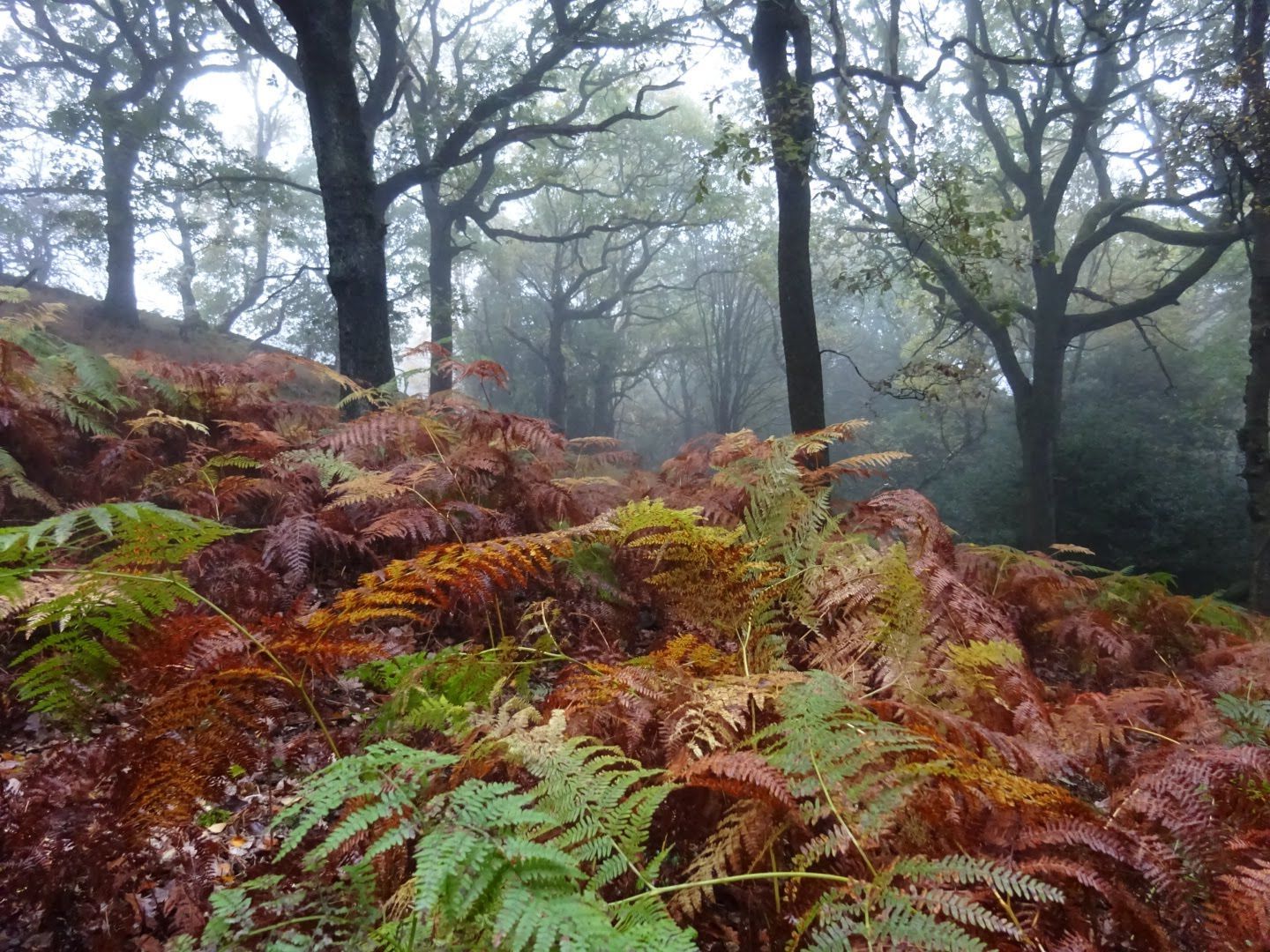
The next step is the fieldwork, to map all the vegetation, rock detail, marshes and streams. For this I used the OOM app, allowing me to update the map in real-time, rather than take paper notes and update the digital version later. The majority of the area is oak and silver birch woodland, with good visibility and runnability. There are also a lot of holly bushes in the area, but the runnability of these varies. Some are mature and actually offer quite fast running, which I've mapped as light green, but most are denser, so mapped as medium green or bright green.
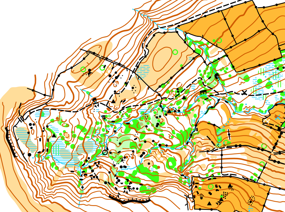
I have used a lot of form lines, some very short, which is perhaps not best practice. I've stuck to the minimum size guidelines for thickets (patches of green), crags, form line hills and paths, but haven't stuck to the guidelines on patches of stony ground, often just using a couple of dots (3 is minimum). Overall though, I'm pleased with how it turned out; I think I've managed to show a good level of detail whilst retaining clarity, which is always the goal.
If you have an area you would like to get mapped, please do contact me! In particular, if you work with a school, having an orienteering map of it made is a fantastic way to get children learning outdoors - it can be used to bring other lessons, like maths and science, out of the classroom, as well as being used for orienteering in PE.