Planning courses - Torsacleit

Hope you enjoyed today despite the inclement weather. Here's the story of Torsacleit from my perspective:
I heard one or two people say it felt like the Lakes today, and indeed, it was a Martin Bagness map (which I thought was excellent). When he sent it to Chris and I, he'd already sketched a rough shape for the long course. I think this is something I'll copy for the future - it lets you think think about distances and the areas with the best terrain without having to attach it to specific control sites.
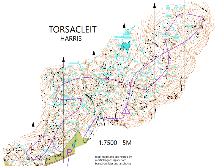
I then had a quick go at doing a course:
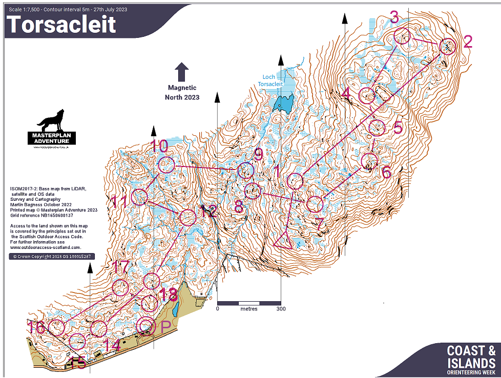
Using a remote start, quite high on the hill, would have meant net downhill courses with less total climb, but it would be quite exposed for the start team on a day like today! Plus, the course above is only 5.3km, and we thought we could get a bit more out of the area, particularly since we'd advertised two long distances and none of the areas were big enough for a 'proper' long distance. So, Chris thought it best to pivot to a start closer to assembly, and so then I had a go at another course:
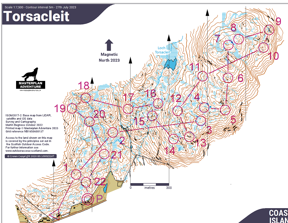
After this, Chris had some spare time so cracked on with drafting a set of four courses, tweaking my Long and adding a Medium, Short and Orange. So now we had done what we could from home and it was time to check things out on the ground! We were fairly happy with the course shapes and distances so my main job was to check the control sites. With it being an open area, we really tried to find sites where the flags weren't visible from the direction of approach, so that people would see the feature before the control. I spent about 4 hours on the hill, going round every control, mostly checking the sites but also thinking a little bit about the terrain, which parts are nice, which parts are rough, any dangerous bits etc.
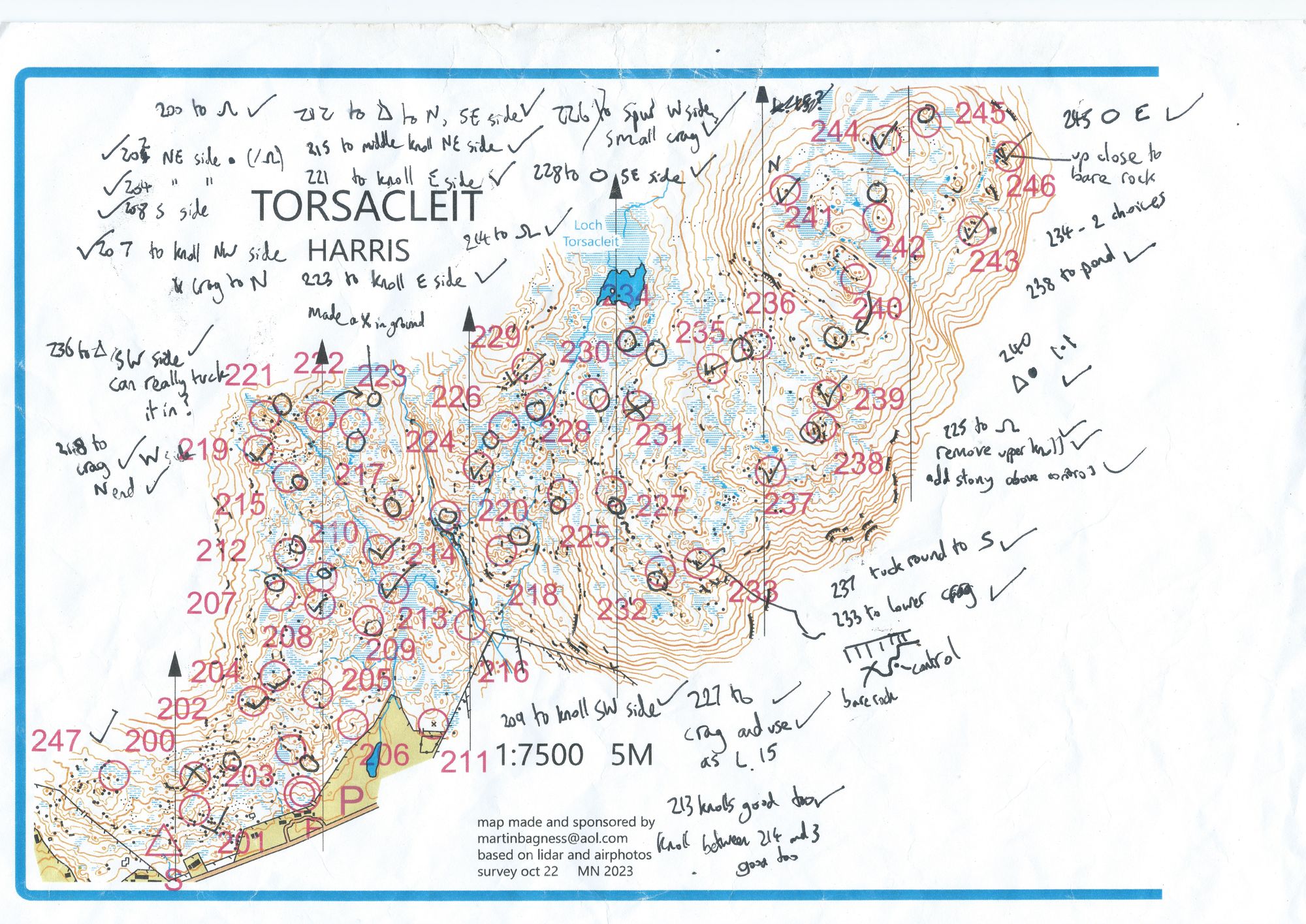
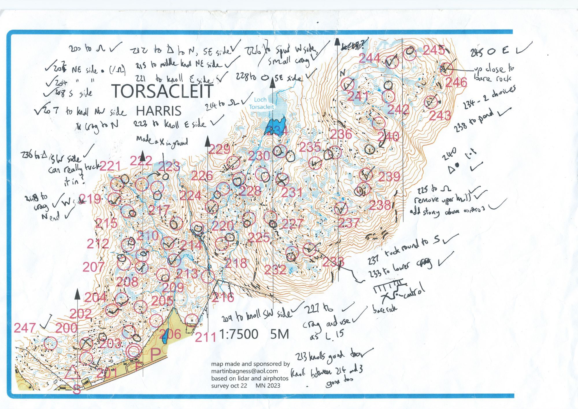
A tick in a control circle, like 241 and 244 in the north-east, means the control site we'd chosen at home was fine - meaning an obvious and fair feature, big enough to conceal a control (if a knoll or boulder) and last but not least, some ground soft enough to stick a stake into (among all the bare rock)!
A circle near an existing control indicates a new site - one I thought was better than the existing site, for example 232, 238, 242, 245. If I needed some extra info, like which side of the new feature, I wrote a note - this is what most of the notes in the top-left are.
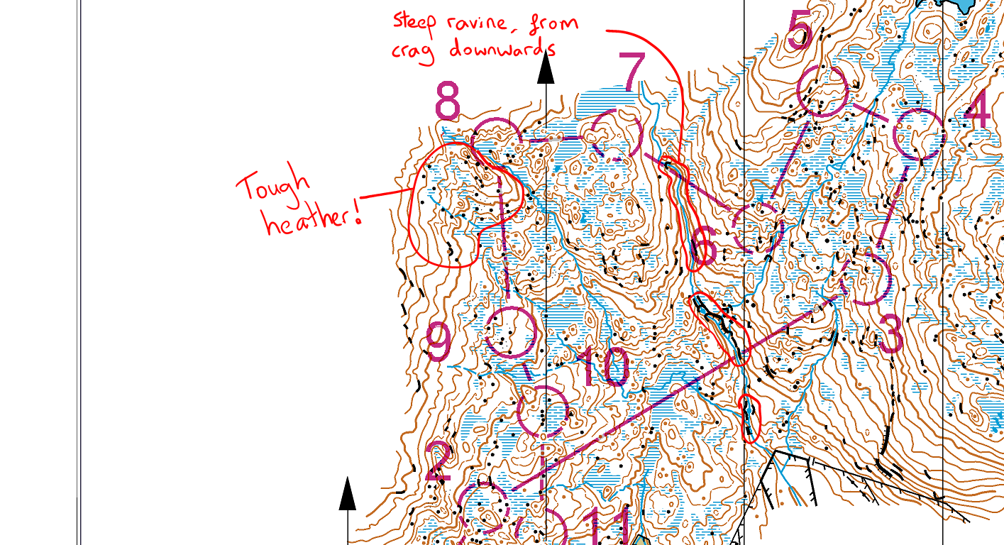
The Short course was the only one I changed the shape of, for two reasons. Firstly, the valley through the middle of the area is really quite steep, and I felt like some of the older competitors would not like to cross the worst parts of it! So, I made sure 2-3 was a long enough leg to give competitors time to choose their 'crossing point'. Hopefully you picked a flatter-looking place to cross! On the way back, I made sure 6 and 7 were high enough that the natural line takes you safely over the top of the crag. I was confident anyone running along the slope from 6 would look at the ravine and choose to stay above it.
Secondly, an area in the north-west where we had originally planned a little loop (same as the Long course) was tough going - deeper heather/tussocks and quite steep, again not ideal for older competitors. So I cut out the loop and re-planned. The straight line from 8 to 9 crosses some of it, but at least it's downhill.
The Orange course was a challenge, with very few line features to use. So, between me and Chris we had the idea to make our own line feature; a string of tapes, which wouldn't necessarily lead to the controls, but close enough that you'd see the controls from it. In hindsight, I think we could have made the tapes do more of a dogleg, so that there would be more of an advantage in attempting to go straight.
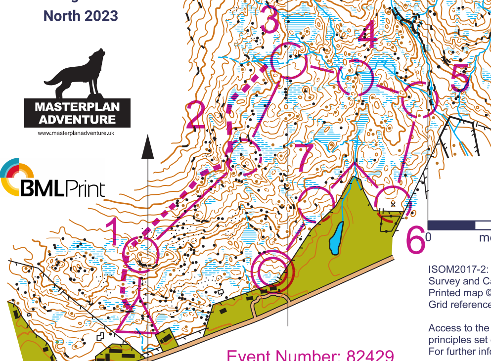
The principle for the rest of the course, as usual for an orange, was to make the controls visible from the line features (and trying to offer some advantage for cutting corners). The slope below 5 was a slight concern, as it is quite steep, but we made sure to hang 5 quite high.
Finally, I was glad we gave each of the Long, Medium and Short a long leg - there wasn't loads of route choice, just how high up you chose to cross the river, but there were a lot of people losing track on the climb up the hill and going astray! So well done if you managed to nail it.
Hope you're looking forward to something a little bit different tomorrow - some trees for a start!